You are here: Home > Network List > TA - USArray Transportable Network (new EarthScope stations) Stations List
> Station V42A Cord, AR, USA > Earthquake Result Viewer
V42A Cord, AR, USA - Earthquake Result Viewer

| Earthquake location: |
Turkey |
| Earthquake latitude/longitude: |
38.7/43.5 |
| Earthquake time(UTC): |
2011/10/23 (296) 10:41:22 GMT |
| Earthquake Depth: |
16 km |
| Earthquake Magnitude: |
6.9 MB, 7.3 MS, 7.3 MW, 7.1 MW |
| Earthquake Catalog/Contributor: |
WHDF/NEIC |
|
| Network: |
TA USArray Transportable Network (new EarthScope stations) |
| Station: |
V42A Cord, AR, USA |
| Lat/Lon: |
35.81 N/91.39 W |
| Elevation: |
134 m |
|
| Distance: |
94.9 deg |
| Az: |
324.698 deg |
| Baz: |
33.788 deg |
| Ray Param: |
0.040912956 |
| Estimated Moho Depth: |
40.0 km |
| Estimated Crust Vp/Vs: |
1.71 |
| Assumed Crust Vp: |
6.273 km/s |
| Estimated Crust Vs: |
3.674 km/s |
| Estimated Crust Poisson's Ratio: |
0.24 |
|
| Radial Match: |
97.57356 % |
| Radial Bump: |
284 |
| Transverse Match: |
86.4332 % |
| Transverse Bump: |
400 |
| SOD ConfigId: |
424168 |
| Insert Time: |
2012-02-16 06:13:11.180 +0000 |
| GWidth: |
2.5 |
| Max Bumps: |
400 |
| Tol: |
0.001 |
|
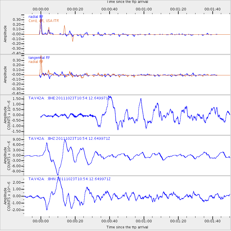
Signal To Noise
| Channel | StoN | STA | LTA |
| TA:V42A: :BHZ:20111023T10:54:12.649971Z | 28.763067 | 3.2128778E-6 | 1.117015E-7 |
| TA:V42A: :BHN:20111023T10:54:12.649971Z | 13.222149 | 8.95575E-7 | 6.773294E-8 |
| TA:V42A: :BHE:20111023T10:54:12.649971Z | 6.198553 | 5.4761296E-7 | 8.834529E-8 |
| Arrivals |
| Ps | 4.6 SECOND |
| PpPs | 17 SECOND |
| PsPs/PpSs | 22 SECOND |


