You are here: Home > Network List > TA - USArray Transportable Network (new EarthScope stations) Stations List
> Station U41A Viola, AR, USA > Earthquake Result Viewer
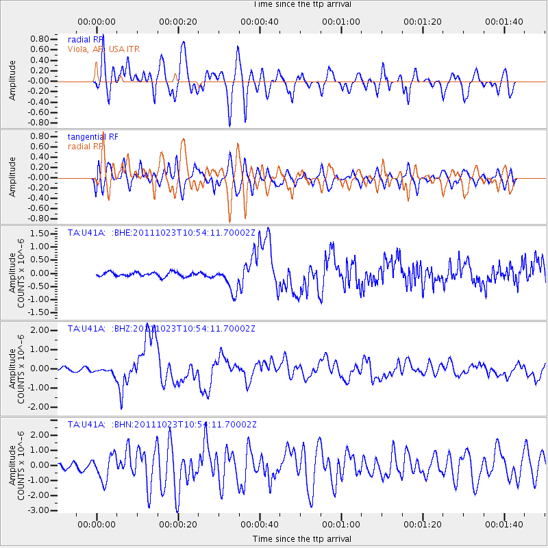
U41A Viola, AR, USA - Earthquake Result Viewer
*The percent match for this event was below the threshold and hence no stack was calculated.
| Earthquake location: |
Turkey |
| Earthquake latitude/longitude: |
38.7/43.5 |
| Earthquake time(UTC): |
2011/10/23 (296) 10:41:22 GMT |
| Earthquake Depth: |
16 km |
| Earthquake Magnitude: |
6.9 MB, 7.3 MS, 7.3 MW, 7.1 MW |
| Earthquake Catalog/Contributor: |
WHDF/NEIC |
|
| Network: |
TA USArray Transportable Network (new EarthScope stations) |
| Station: |
U41A Viola, AR, USA |
| Lat/Lon: |
36.34 N/91.92 W |
| Elevation: |
300 m |
|
| Distance: |
94.7 deg |
| Az: |
325.355 deg |
| Baz: |
33.422 deg |
| Ray Param: |
$rayparam |
*The percent match for this event was below the threshold and hence was not used in the summary stack. |
|
| Radial Match: |
60.96081 % |
| Radial Bump: |
400 |
| Transverse Match: |
53.18792 % |
| Transverse Bump: |
400 |
| SOD ConfigId: |
424168 |
| Insert Time: |
2012-02-16 06:16:18.079 +0000 |
| GWidth: |
2.5 |
| Max Bumps: |
400 |
| Tol: |
0.001 |
|
Signal To Noise
| Channel | StoN | STA | LTA |
| TA:U41A: :BHZ:20111023T10:54:11.70002Z | 2.5965571 | 1.7916794E-7 | 6.900211E-8 |
| TA:U41A: :BHN:20111023T10:54:11.70002Z | 4.544873 | 8.494108E-7 | 1.8689428E-7 |
| TA:U41A: :BHE:20111023T10:54:11.70002Z | 5.811315 | 4.7848283E-7 | 8.233641E-8 |
| Arrivals |
| Ps | |
| PpPs | |
| PsPs/PpSs | |


