You are here: Home > Network List > TA - USArray Transportable Network (new EarthScope stations) Stations List
> Station U44A Portageville, MO, USA > Earthquake Result Viewer
U44A Portageville, MO, USA - Earthquake Result Viewer
*The percent match for this event was below the threshold and hence no stack was calculated.
| Earthquake location: |
Turkey |
| Earthquake latitude/longitude: |
38.7/43.5 |
| Earthquake time(UTC): |
2011/10/23 (296) 10:41:22 GMT |
| Earthquake Depth: |
16 km |
| Earthquake Magnitude: |
6.9 MB, 7.3 MS, 7.3 MW, 7.1 MW |
| Earthquake Catalog/Contributor: |
WHDF/NEIC |
|
| Network: |
TA USArray Transportable Network (new EarthScope stations) |
| Station: |
U44A Portageville, MO, USA |
| Lat/Lon: |
36.50 N/89.69 W |
| Elevation: |
89 m |
|
| Distance: |
93.6 deg |
| Az: |
323.95 deg |
| Baz: |
34.844 deg |
| Ray Param: |
$rayparam |
*The percent match for this event was below the threshold and hence was not used in the summary stack. |
|
| Radial Match: |
50.60837 % |
| Radial Bump: |
400 |
| Transverse Match: |
56.546818 % |
| Transverse Bump: |
400 |
| SOD ConfigId: |
424168 |
| Insert Time: |
2012-02-16 06:17:24.585 +0000 |
| GWidth: |
2.5 |
| Max Bumps: |
400 |
| Tol: |
0.001 |
|
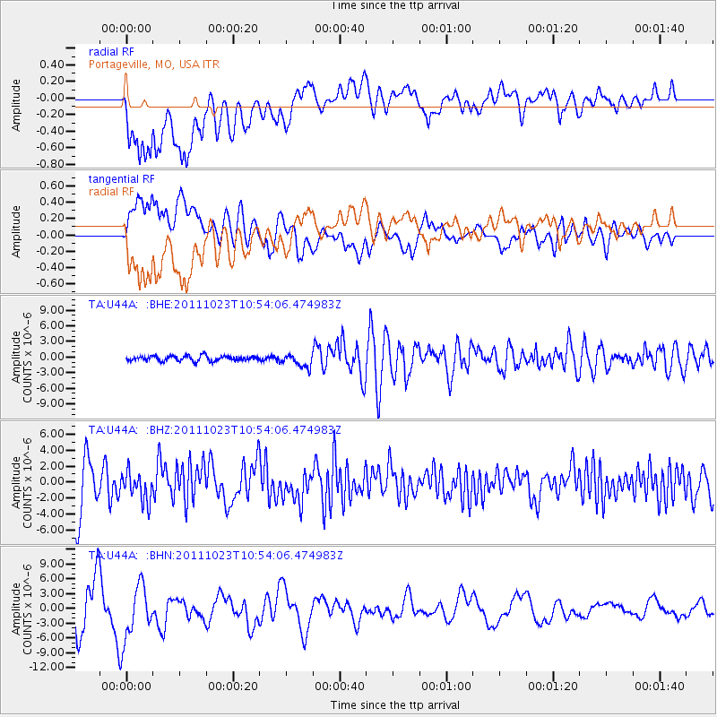
Signal To Noise
| Channel | StoN | STA | LTA |
| TA:U44A: :BHZ:20111023T10:54:06.474983Z | 0.47117102 | 1.8093208E-6 | 3.8400512E-6 |
| TA:U44A: :BHN:20111023T10:54:06.474983Z | 0.5472613 | 5.446297E-6 | 9.951913E-6 |
| TA:U44A: :BHE:20111023T10:54:06.474983Z | 2.6432927 | 1.2914853E-6 | 4.885896E-7 |
| Arrivals |
| Ps | |
| PpPs | |
| PsPs/PpSs | |


