You are here: Home > Network List > TA - USArray Transportable Network (new EarthScope stations) Stations List
> Station X38A Whitesboro, OK, USA > Earthquake Result Viewer
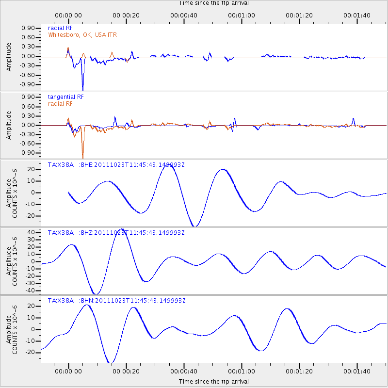
X38A Whitesboro, OK, USA - Earthquake Result Viewer
*The percent match for this event was below the threshold and hence no stack was calculated.
| Earthquake location: |
Turkey |
| Earthquake latitude/longitude: |
38.8/43.3 |
| Earthquake time(UTC): |
2011/10/23 (296) 11:32:41 GMT |
| Earthquake Depth: |
5.0 km |
| Earthquake Magnitude: |
5.7 MB, 5.5 ML |
| Earthquake Catalog/Contributor: |
WHDF/NEIC |
|
| Network: |
TA USArray Transportable Network (new EarthScope stations) |
| Station: |
X38A Whitesboro, OK, USA |
| Lat/Lon: |
34.67 N/94.83 W |
| Elevation: |
234 m |
|
| Distance: |
97.2 deg |
| Az: |
326.319 deg |
| Baz: |
31.714 deg |
| Ray Param: |
$rayparam |
*The percent match for this event was below the threshold and hence was not used in the summary stack. |
|
| Radial Match: |
86.09883 % |
| Radial Bump: |
400 |
| Transverse Match: |
91.83555 % |
| Transverse Bump: |
400 |
| SOD ConfigId: |
424168 |
| Insert Time: |
2012-02-16 07:18:13.254 +0000 |
| GWidth: |
2.5 |
| Max Bumps: |
400 |
| Tol: |
0.001 |
|
Signal To Noise
| Channel | StoN | STA | LTA |
| TA:X38A: :BHZ:20111023T11:45:43.149993Z | 4.243674 | 2.0566371E-5 | 4.8463603E-6 |
| TA:X38A: :BHN:20111023T11:45:43.149993Z | 0.9223592 | 1.1319046E-5 | 1.2271842E-5 |
| TA:X38A: :BHE:20111023T11:45:43.149993Z | 2.220912 | 1.7969372E-5 | 8.090989E-6 |
| Arrivals |
| Ps | |
| PpPs | |
| PsPs/PpSs | |


