You are here: Home > Network List > TA - USArray Transportable Network (new EarthScope stations) Stations List
> Station T44A Benton, MO, USA > Earthquake Result Viewer
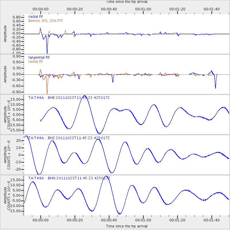
T44A Benton, MO, USA - Earthquake Result Viewer
*The percent match for this event was below the threshold and hence no stack was calculated.
| Earthquake location: |
Turkey |
| Earthquake latitude/longitude: |
38.8/43.3 |
| Earthquake time(UTC): |
2011/10/23 (296) 11:32:41 GMT |
| Earthquake Depth: |
5.0 km |
| Earthquake Magnitude: |
5.7 MB, 5.5 ML |
| Earthquake Catalog/Contributor: |
WHDF/NEIC |
|
| Network: |
TA USArray Transportable Network (new EarthScope stations) |
| Station: |
T44A Benton, MO, USA |
| Lat/Lon: |
37.09 N/89.59 W |
| Elevation: |
133 m |
|
| Distance: |
92.9 deg |
| Az: |
324.081 deg |
| Baz: |
34.97 deg |
| Ray Param: |
$rayparam |
*The percent match for this event was below the threshold and hence was not used in the summary stack. |
|
| Radial Match: |
95.48739 % |
| Radial Bump: |
400 |
| Transverse Match: |
60.57857 % |
| Transverse Bump: |
381 |
| SOD ConfigId: |
424168 |
| Insert Time: |
2012-02-16 07:22:39.447 +0000 |
| GWidth: |
2.5 |
| Max Bumps: |
400 |
| Tol: |
0.001 |
|
Signal To Noise
| Channel | StoN | STA | LTA |
| TA:T44A: :BHZ:20111023T11:45:23.425017Z | 1.403229 | 1.9210931E-5 | 1.3690517E-5 |
| TA:T44A: :BHN:20111023T11:45:23.425017Z | 0.9155894 | 7.5033527E-6 | 8.195107E-6 |
| TA:T44A: :BHE:20111023T11:45:23.425017Z | 1.440337 | 1.1854183E-5 | 8.230146E-6 |
| Arrivals |
| Ps | |
| PpPs | |
| PsPs/PpSs | |


