You are here: Home > Network List > TA - USArray Transportable Network (new EarthScope stations) Stations List
> Station U35A Pawnee, OK, USA > Earthquake Result Viewer
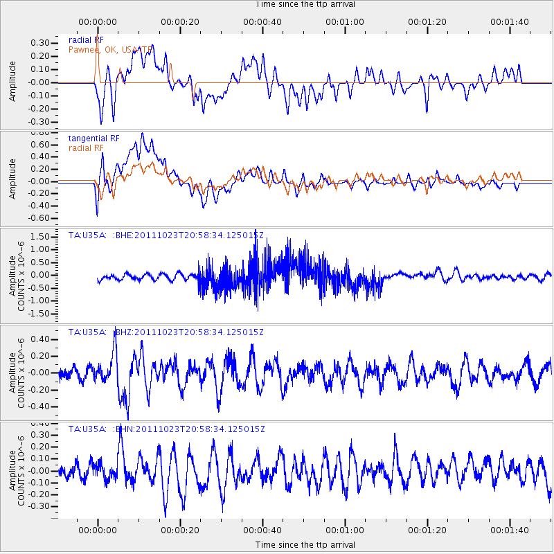
U35A Pawnee, OK, USA - Earthquake Result Viewer
*The percent match for this event was below the threshold and hence no stack was calculated.
| Earthquake location: |
Turkey |
| Earthquake latitude/longitude: |
38.6/43.1 |
| Earthquake time(UTC): |
2011/10/23 (296) 20:45:34 GMT |
| Earthquake Depth: |
5.0 km |
| Earthquake Magnitude: |
6.0 MB, 5.6 MS, 6.0 MW, 5.9 MW |
| Earthquake Catalog/Contributor: |
WHDF/NEIC |
|
| Network: |
TA USArray Transportable Network (new EarthScope stations) |
| Station: |
U35A Pawnee, OK, USA |
| Lat/Lon: |
36.37 N/96.73 W |
| Elevation: |
303 m |
|
| Distance: |
96.6 deg |
| Az: |
328.374 deg |
| Baz: |
30.587 deg |
| Ray Param: |
$rayparam |
*The percent match for this event was below the threshold and hence was not used in the summary stack. |
|
| Radial Match: |
43.326046 % |
| Radial Bump: |
400 |
| Transverse Match: |
40.77666 % |
| Transverse Bump: |
400 |
| SOD ConfigId: |
424168 |
| Insert Time: |
2012-02-16 07:47:08.772 +0000 |
| GWidth: |
2.5 |
| Max Bumps: |
400 |
| Tol: |
0.001 |
|
Signal To Noise
| Channel | StoN | STA | LTA |
| TA:U35A: :BHZ:20111023T20:58:34.125015Z | 1.7844977 | 1.8240829E-7 | 1.0221828E-7 |
| TA:U35A: :BHN:20111023T20:58:34.125015Z | 0.6456566 | 6.069039E-8 | 9.399793E-8 |
| TA:U35A: :BHE:20111023T20:58:34.125015Z | 3.2515054 | 4.0393056E-7 | 1.2422878E-7 |
| Arrivals |
| Ps | |
| PpPs | |
| PsPs/PpSs | |


