You are here: Home > Network List > TA - USArray Transportable Network (new EarthScope stations) Stations List
> Station A33A Warroad, MN, USA > Earthquake Result Viewer
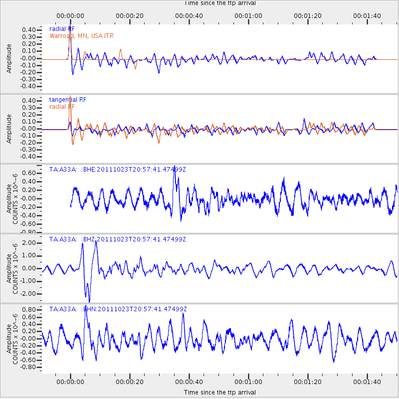
A33A Warroad, MN, USA - Earthquake Result Viewer
*The percent match for this event was below the threshold and hence no stack was calculated.
| Earthquake location: |
Turkey |
| Earthquake latitude/longitude: |
38.6/43.1 |
| Earthquake time(UTC): |
2011/10/23 (296) 20:45:34 GMT |
| Earthquake Depth: |
5.0 km |
| Earthquake Magnitude: |
6.0 MB, 5.6 MS, 6.0 MW, 5.9 MW |
| Earthquake Catalog/Contributor: |
WHDF/NEIC |
|
| Network: |
TA USArray Transportable Network (new EarthScope stations) |
| Station: |
A33A Warroad, MN, USA |
| Lat/Lon: |
48.94 N/95.39 W |
| Elevation: |
329 m |
|
| Distance: |
85.4 deg |
| Az: |
333.983 deg |
| Baz: |
31.399 deg |
| Ray Param: |
$rayparam |
*The percent match for this event was below the threshold and hence was not used in the summary stack. |
|
| Radial Match: |
71.335304 % |
| Radial Bump: |
400 |
| Transverse Match: |
75.44794 % |
| Transverse Bump: |
400 |
| SOD ConfigId: |
424168 |
| Insert Time: |
2012-02-16 07:51:36.472 +0000 |
| GWidth: |
2.5 |
| Max Bumps: |
400 |
| Tol: |
0.001 |
|
Signal To Noise
| Channel | StoN | STA | LTA |
| TA:A33A: :BHZ:20111023T20:57:41.47499Z | 4.883122 | 7.167562E-7 | 1.4678236E-7 |
| TA:A33A: :BHN:20111023T20:57:41.47499Z | 1.3551384 | 2.2926832E-7 | 1.6918443E-7 |
| TA:A33A: :BHE:20111023T20:57:41.47499Z | 1.412668 | 2.1545758E-7 | 1.5251818E-7 |
| Arrivals |
| Ps | |
| PpPs | |
| PsPs/PpSs | |


