
HYB Hyderabad, India - Earthquake Result Viewer
| ||||||||||||||||||
| ||||||||||||||||||
| ||||||||||||||||||
|
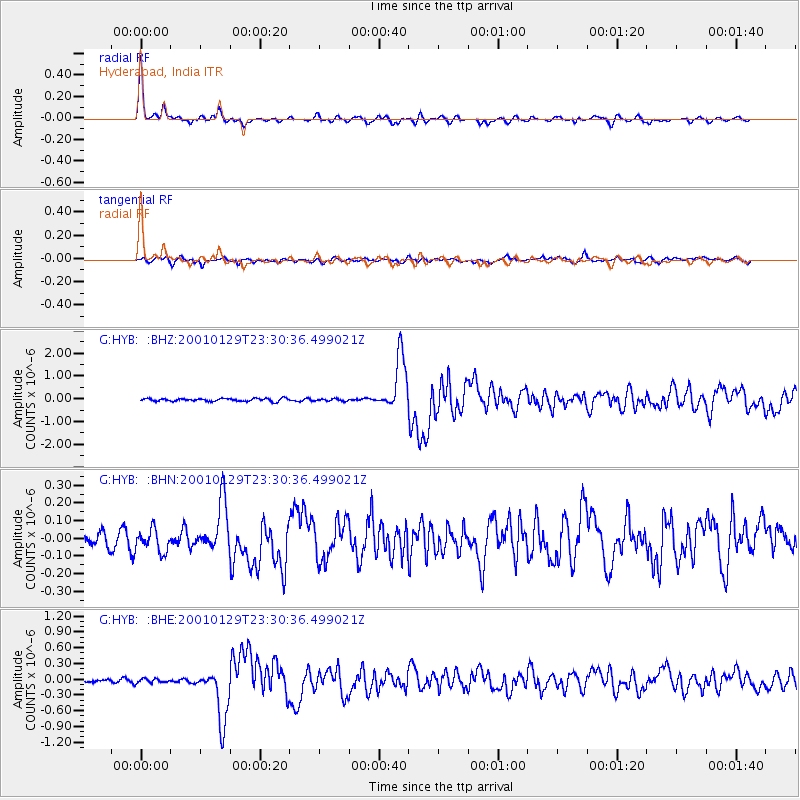
Signal To Noise
| Channel | StoN | STA | LTA |
| G:HYB: :BHN:20010129T23:30:36.499021Z | 1.3794305 | 6.295224E-8 | 4.5636394E-8 |
| G:HYB: :BHE:20010129T23:30:36.499021Z | 0.8927883 | 3.8984698E-8 | 4.366623E-8 |
| G:HYB: :BHZ:20010129T23:30:36.499021Z | 0.8059453 | 5.0488445E-8 | 6.264501E-8 |
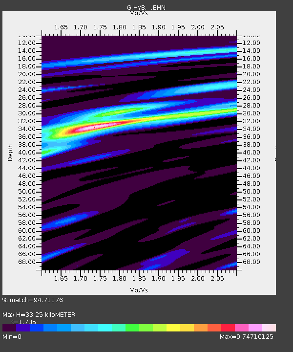
| Arrivals | |
| Ps | 4.0 SECOND |
| PpPs | 13 SECOND |
| PsPs/PpSs | 17 SECOND |

