You are here: Home > Network List > TA - USArray Transportable Network (new EarthScope stations) Stations List
> Station M38A Pleasantville, IA, USA > Earthquake Result Viewer
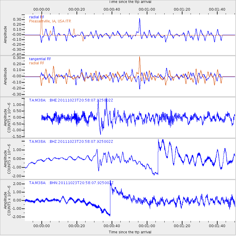
M38A Pleasantville, IA, USA - Earthquake Result Viewer
*The percent match for this event was below the threshold and hence no stack was calculated.
| Earthquake location: |
Turkey |
| Earthquake latitude/longitude: |
38.6/43.1 |
| Earthquake time(UTC): |
2011/10/23 (296) 20:45:34 GMT |
| Earthquake Depth: |
5.0 km |
| Earthquake Magnitude: |
6.0 MB, 5.6 MS, 6.0 MW, 5.9 MW |
| Earthquake Catalog/Contributor: |
WHDF/NEIC |
|
| Network: |
TA USArray Transportable Network (new EarthScope stations) |
| Station: |
M38A Pleasantville, IA, USA |
| Lat/Lon: |
41.42 N/93.20 W |
| Elevation: |
258 m |
|
| Distance: |
90.9 deg |
| Az: |
328.672 deg |
| Baz: |
32.781 deg |
| Ray Param: |
$rayparam |
*The percent match for this event was below the threshold and hence was not used in the summary stack. |
|
| Radial Match: |
45.580826 % |
| Radial Bump: |
398 |
| Transverse Match: |
42.722725 % |
| Transverse Bump: |
400 |
| SOD ConfigId: |
424168 |
| Insert Time: |
2012-02-16 07:54:36.473 +0000 |
| GWidth: |
2.5 |
| Max Bumps: |
400 |
| Tol: |
0.001 |
|
Signal To Noise
| Channel | StoN | STA | LTA |
| TA:M38A: :BHZ:20111023T20:58:07.925002Z | 0.3912024 | 5.7682917E-7 | 1.4745032E-6 |
| TA:M38A: :BHN:20111023T20:58:07.925002Z | 0.17451574 | 1.4424472E-7 | 8.265428E-7 |
| TA:M38A: :BHE:20111023T20:58:07.925002Z | 3.0323336 | 6.0667395E-7 | 2.0006833E-7 |
| Arrivals |
| Ps | |
| PpPs | |
| PsPs/PpSs | |


