You are here: Home > Network List > TA - USArray Transportable Network (new EarthScope stations) Stations List
> Station I41A Arkdale, WI, USA > Earthquake Result Viewer
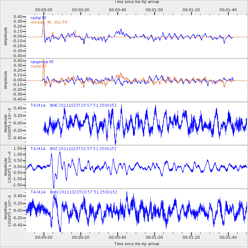
I41A Arkdale, WI, USA - Earthquake Result Viewer
*The percent match for this event was below the threshold and hence no stack was calculated.
| Earthquake location: |
Turkey |
| Earthquake latitude/longitude: |
38.6/43.1 |
| Earthquake time(UTC): |
2011/10/23 (296) 20:45:34 GMT |
| Earthquake Depth: |
5.0 km |
| Earthquake Magnitude: |
6.0 MB, 5.6 MS, 6.0 MW, 5.9 MW |
| Earthquake Catalog/Contributor: |
WHDF/NEIC |
|
| Network: |
TA USArray Transportable Network (new EarthScope stations) |
| Station: |
I41A Arkdale, WI, USA |
| Lat/Lon: |
44.06 N/89.87 W |
| Elevation: |
289 m |
|
| Distance: |
87.4 deg |
| Az: |
328.11 deg |
| Baz: |
35.022 deg |
| Ray Param: |
$rayparam |
*The percent match for this event was below the threshold and hence was not used in the summary stack. |
|
| Radial Match: |
63.76495 % |
| Radial Bump: |
400 |
| Transverse Match: |
62.380024 % |
| Transverse Bump: |
400 |
| SOD ConfigId: |
424168 |
| Insert Time: |
2012-02-16 08:02:24.462 +0000 |
| GWidth: |
2.5 |
| Max Bumps: |
400 |
| Tol: |
0.001 |
|
Signal To Noise
| Channel | StoN | STA | LTA |
| TA:I41A: :BHZ:20111023T20:57:51.250015Z | 2.7012813 | 3.7255253E-7 | 1.3791696E-7 |
| TA:I41A: :BHN:20111023T20:57:51.250015Z | 1.2332952 | 1.5486496E-7 | 1.2557007E-7 |
| TA:I41A: :BHE:20111023T20:57:51.250015Z | 1.3019414 | 1.8486038E-7 | 1.4198825E-7 |
| Arrivals |
| Ps | |
| PpPs | |
| PsPs/PpSs | |


