You are here: Home > Network List > CI - Caltech Regional Seismic Network Stations List
> Station FUR Furnace Creek, CA, USA > Earthquake Result Viewer
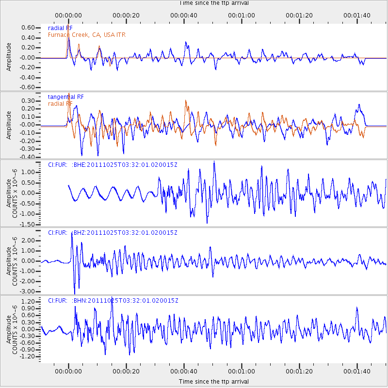
FUR Furnace Creek, CA, USA - Earthquake Result Viewer
*The percent match for this event was below the threshold and hence no stack was calculated.
| Earthquake location: |
Fox Islands, Aleutian Islands |
| Earthquake latitude/longitude: |
52.2/-171.8 |
| Earthquake time(UTC): |
2011/10/25 (298) 03:24:49 GMT |
| Earthquake Depth: |
38 km |
| Earthquake Magnitude: |
5.9 MB, 5.3 MS, 5.7 MW, 5.7 MW |
| Earthquake Catalog/Contributor: |
WHDF/NEIC |
|
| Network: |
CI Caltech Regional Seismic Network |
| Station: |
FUR Furnace Creek, CA, USA |
| Lat/Lon: |
36.47 N/116.86 W |
| Elevation: |
-37.0 m |
|
| Distance: |
41.3 deg |
| Az: |
89.999 deg |
| Baz: |
310.162 deg |
| Ray Param: |
$rayparam |
*The percent match for this event was below the threshold and hence was not used in the summary stack. |
|
| Radial Match: |
65.0932 % |
| Radial Bump: |
400 |
| Transverse Match: |
68.28273 % |
| Transverse Bump: |
400 |
| SOD ConfigId: |
424168 |
| Insert Time: |
2012-02-16 08:23:27.918 +0000 |
| GWidth: |
2.5 |
| Max Bumps: |
400 |
| Tol: |
0.001 |
|
Signal To Noise
| Channel | StoN | STA | LTA |
| CI:FUR: :BHZ:20111025T03:32:01.020015Z | 7.4554486 | 1.3719125E-6 | 1.8401475E-7 |
| CI:FUR: :BHN:20111025T03:32:01.020015Z | 2.0065196 | 3.6609026E-7 | 1.8245038E-7 |
| CI:FUR: :BHE:20111025T03:32:01.020015Z | 1.7440659 | 3.6065387E-7 | 2.0678912E-7 |
| Arrivals |
| Ps | |
| PpPs | |
| PsPs/PpSs | |


