You are here: Home > Network List > TA - USArray Transportable Network (new EarthScope stations) Stations List
> Station G59A Clarenceville, QC, USA > Earthquake Result Viewer
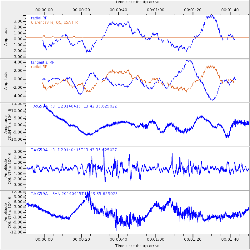
G59A Clarenceville, QC, USA - Earthquake Result Viewer
*The percent match for this event was below the threshold and hence no stack was calculated.
| Earthquake location: |
Southeast Of Easter Island |
| Earthquake latitude/longitude: |
-36.1/-101.2 |
| Earthquake time(UTC): |
2014/04/15 (105) 13:31:33 GMT |
| Earthquake Depth: |
14 km |
| Earthquake Magnitude: |
5.6 MW |
| Earthquake Catalog/Contributor: |
ISC/ISC |
|
| Network: |
TA USArray Transportable Network (new EarthScope stations) |
| Station: |
G59A Clarenceville, QC, USA |
| Lat/Lon: |
45.08 N/73.18 W |
| Elevation: |
36 m |
|
| Distance: |
84.7 deg |
| Az: |
19.514 deg |
| Baz: |
202.454 deg |
| Ray Param: |
$rayparam |
*The percent match for this event was below the threshold and hence was not used in the summary stack. |
|
| Radial Match: |
31.093468 % |
| Radial Bump: |
400 |
| Transverse Match: |
31.331009 % |
| Transverse Bump: |
400 |
| SOD ConfigId: |
3390531 |
| Insert Time: |
2019-04-11 10:10:26.753 +0000 |
| GWidth: |
2.5 |
| Max Bumps: |
400 |
| Tol: |
0.001 |
|
Signal To Noise
| Channel | StoN | STA | LTA |
| TA:G59A: :BHZ:20140415T13:43:35.62502Z | 1.0697049 | 2.7762184E-7 | 2.5953125E-7 |
| TA:G59A: :BHN:20140415T13:43:35.62502Z | 0.46843436 | 5.016935E-6 | 1.0710007E-5 |
| TA:G59A: :BHE:20140415T13:43:35.62502Z | 0.62393063 | 3.708287E-6 | 5.9434287E-6 |
| Arrivals |
| Ps | |
| PpPs | |
| PsPs/PpSs | |


