
HYB Hyderabad, India - Earthquake Result Viewer
| ||||||||||||||||||
| ||||||||||||||||||
| ||||||||||||||||||
|
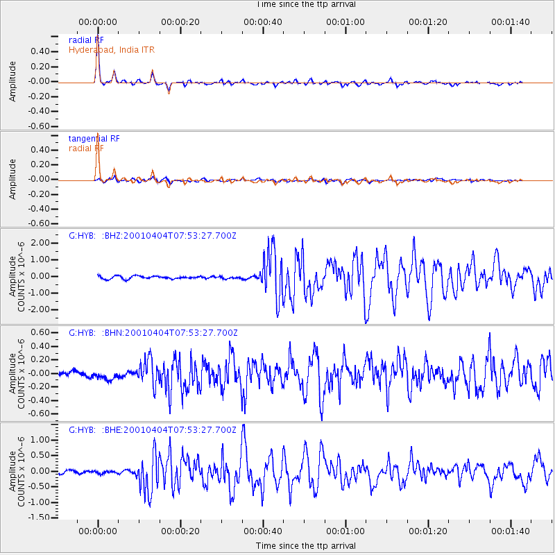
Signal To Noise
| Channel | StoN | STA | LTA |
| G:HYB: :BHN:20010404T07:53:27.700Z | 1.6294738 | 9.681645E-8 | 5.9415775E-8 |
| G:HYB: :BHE:20010404T07:53:27.700Z | 0.68060684 | 3.754351E-8 | 5.5161813E-8 |
| G:HYB: :BHZ:20010404T07:53:27.700Z | 0.6789763 | 5.850394E-8 | 8.6164924E-8 |
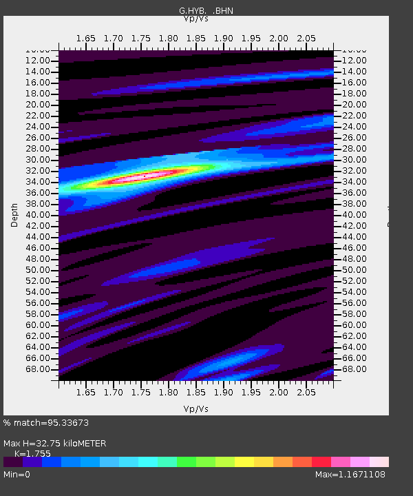
| Arrivals | |
| Ps | 4.0 SECOND |
| PpPs | 13 SECOND |
| PsPs/PpSs | 17 SECOND |

