You are here: Home > Network List > IW - Intermountain West Stations List
> Station MOOW Moose Ponds, Wyoming, USA > Earthquake Result Viewer
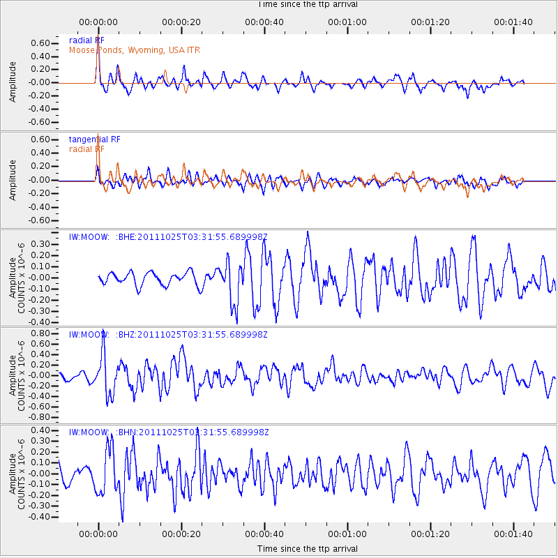
MOOW Moose Ponds, Wyoming, USA - Earthquake Result Viewer
*The percent match for this event was below the threshold and hence no stack was calculated.
| Earthquake location: |
Fox Islands, Aleutian Islands |
| Earthquake latitude/longitude: |
52.2/-171.8 |
| Earthquake time(UTC): |
2011/10/25 (298) 03:24:49 GMT |
| Earthquake Depth: |
38 km |
| Earthquake Magnitude: |
5.9 MB, 5.3 MS, 5.7 MW, 5.7 MW |
| Earthquake Catalog/Contributor: |
WHDF/NEIC |
|
| Network: |
IW Intermountain West |
| Station: |
MOOW Moose Ponds, Wyoming, USA |
| Lat/Lon: |
43.75 N/110.74 W |
| Elevation: |
2128 m |
|
| Distance: |
40.7 deg |
| Az: |
76.829 deg |
| Baz: |
304.136 deg |
| Ray Param: |
$rayparam |
*The percent match for this event was below the threshold and hence was not used in the summary stack. |
|
| Radial Match: |
74.39938 % |
| Radial Bump: |
400 |
| Transverse Match: |
72.200195 % |
| Transverse Bump: |
400 |
| SOD ConfigId: |
424168 |
| Insert Time: |
2012-02-16 08:32:36.966 +0000 |
| GWidth: |
2.5 |
| Max Bumps: |
400 |
| Tol: |
0.001 |
|
Signal To Noise
| Channel | StoN | STA | LTA |
| IW:MOOW: :BHZ:20111025T03:31:55.689998Z | 5.1782565 | 3.8861435E-7 | 7.504734E-8 |
| IW:MOOW: :BHN:20111025T03:31:55.689998Z | 3.1093848 | 2.0877157E-7 | 6.71424E-8 |
| IW:MOOW: :BHE:20111025T03:31:55.689998Z | 3.296724 | 1.85379E-7 | 5.6231276E-8 |
| Arrivals |
| Ps | |
| PpPs | |
| PsPs/PpSs | |


