You are here: Home > Network List > US - United States National Seismic Network Stations List
> Station AMTX Amarillo, Texas, USA > Earthquake Result Viewer
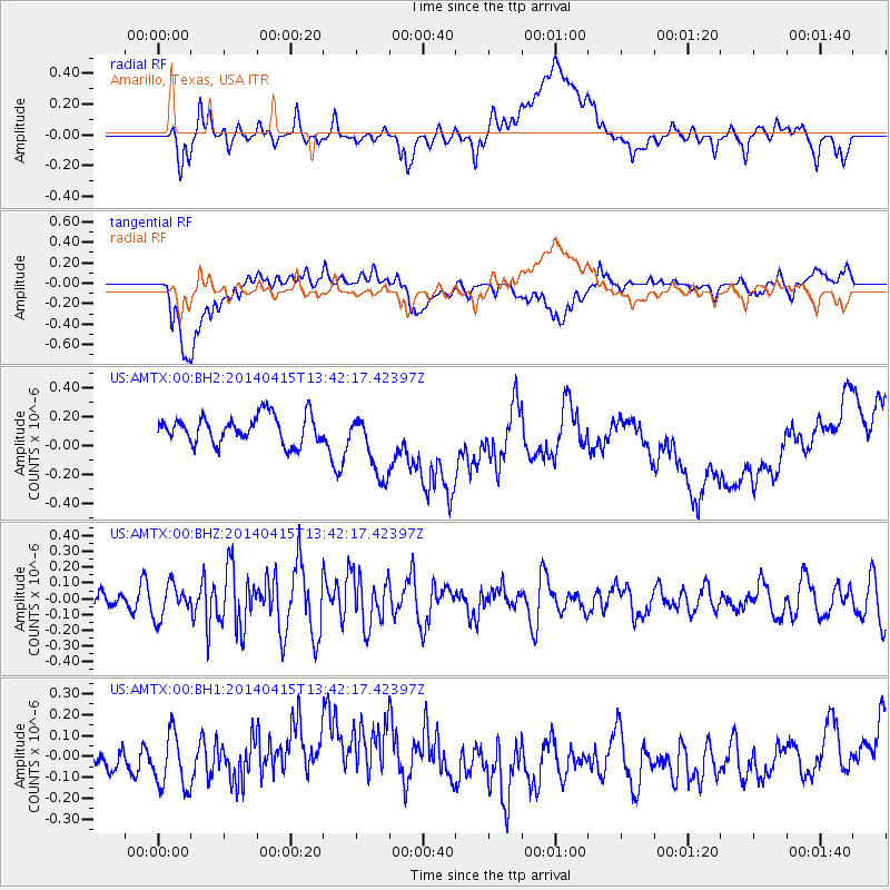
AMTX Amarillo, Texas, USA - Earthquake Result Viewer
*The percent match for this event was below the threshold and hence no stack was calculated.
| Earthquake location: |
Southeast Of Easter Island |
| Earthquake latitude/longitude: |
-36.1/-101.2 |
| Earthquake time(UTC): |
2014/04/15 (105) 13:31:33 GMT |
| Earthquake Depth: |
14 km |
| Earthquake Magnitude: |
5.6 MW |
| Earthquake Catalog/Contributor: |
ISC/ISC |
|
| Network: |
US United States National Seismic Network |
| Station: |
AMTX Amarillo, Texas, USA |
| Lat/Lon: |
34.53 N/101.41 W |
| Elevation: |
1010 m |
|
| Distance: |
70.2 deg |
| Az: |
359.798 deg |
| Baz: |
179.802 deg |
| Ray Param: |
$rayparam |
*The percent match for this event was below the threshold and hence was not used in the summary stack. |
|
| Radial Match: |
51.486378 % |
| Radial Bump: |
400 |
| Transverse Match: |
17.118273 % |
| Transverse Bump: |
400 |
| SOD ConfigId: |
3390531 |
| Insert Time: |
2019-04-11 10:11:53.713 +0000 |
| GWidth: |
2.5 |
| Max Bumps: |
400 |
| Tol: |
0.001 |
|
Signal To Noise
| Channel | StoN | STA | LTA |
| US:AMTX:00:BHZ:20140415T13:42:17.42397Z | 1.6137165 | 1.0363907E-7 | 6.422384E-8 |
| US:AMTX:00:BH1:20140415T13:42:17.42397Z | 1.1779081 | 1.2650452E-7 | 1.0739761E-7 |
| US:AMTX:00:BH2:20140415T13:42:17.42397Z | 1.8220491 | 1.7374316E-7 | 9.5355915E-8 |
| Arrivals |
| Ps | |
| PpPs | |
| PsPs/PpSs | |


