You are here: Home > Network List > UW - Pacific Northwest Regional Seismic Network Stations List
> Station PASS Maple Falls, WA, USA > Earthquake Result Viewer
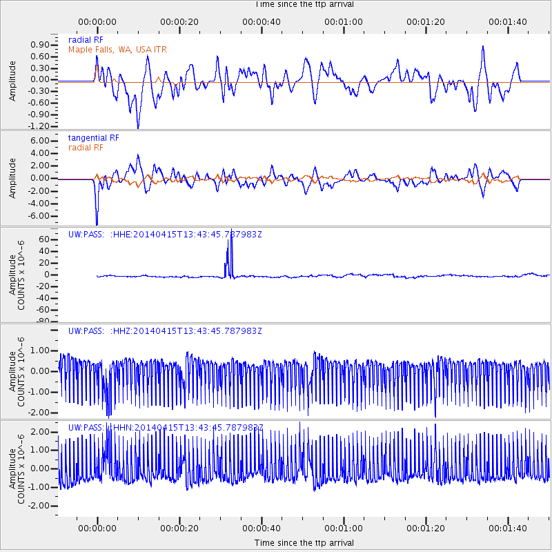
PASS Maple Falls, WA, USA - Earthquake Result Viewer
*The percent match for this event was below the threshold and hence no stack was calculated.
| Earthquake location: |
Southeast Of Easter Island |
| Earthquake latitude/longitude: |
-36.1/-101.2 |
| Earthquake time(UTC): |
2014/04/15 (105) 13:31:33 GMT |
| Earthquake Depth: |
14 km |
| Earthquake Magnitude: |
5.6 MW |
| Earthquake Catalog/Contributor: |
ISC/ISC |
|
| Network: |
UW Pacific Northwest Regional Seismic Network |
| Station: |
PASS Maple Falls, WA, USA |
| Lat/Lon: |
49.00 N/122.09 W |
| Elevation: |
174 m |
|
| Distance: |
86.7 deg |
| Az: |
346.384 deg |
| Baz: |
163.168 deg |
| Ray Param: |
$rayparam |
*The percent match for this event was below the threshold and hence was not used in the summary stack. |
|
| Radial Match: |
53.114464 % |
| Radial Bump: |
400 |
| Transverse Match: |
59.273727 % |
| Transverse Bump: |
400 |
| SOD ConfigId: |
3390531 |
| Insert Time: |
2019-04-11 10:12:15.599 +0000 |
| GWidth: |
2.5 |
| Max Bumps: |
400 |
| Tol: |
0.001 |
|
Signal To Noise
| Channel | StoN | STA | LTA |
| UW:PASS: :HHZ:20140415T13:43:45.787983Z | 1.2657887 | 8.851216E-7 | 6.9926494E-7 |
| UW:PASS: :HHN:20140415T13:43:45.787983Z | 1.2274532 | 9.706469E-7 | 7.9078114E-7 |
| UW:PASS: :HHE:20140415T13:43:45.787983Z | 18.659256 | 1.927982E-5 | 1.0332577E-6 |
| Arrivals |
| Ps | |
| PpPs | |
| PsPs/PpSs | |


