
K33A Hardington, NE, USA - Earthquake Result Viewer
| ||||||||||||||||||
| ||||||||||||||||||
| ||||||||||||||||||
|
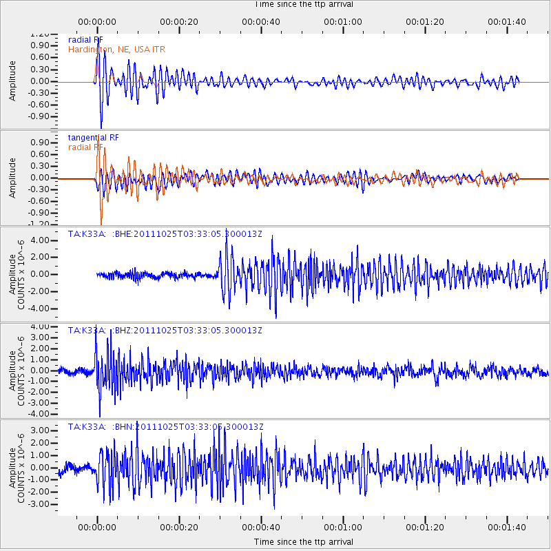
Signal To Noise
| Channel | StoN | STA | LTA |
| TA:K33A: :BHZ:20111025T03:33:05.300013Z | 7.7893677 | 1.7740825E-6 | 2.2775694E-7 |
| TA:K33A: :BHN:20111025T03:33:05.300013Z | 4.7332754 | 1.3928208E-6 | 2.9426153E-7 |
| TA:K33A: :BHE:20111025T03:33:05.300013Z | 6.9705143 | 2.08297E-6 | 2.9882588E-7 |
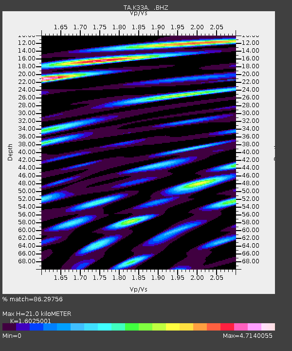
| Arrivals | |
| Ps | 2.1 SECOND |
| PpPs | 7.9 SECOND |
| PsPs/PpSs | 9.9 SECOND |

