You are here: Home > Network List > TA - USArray Transportable Network (new EarthScope stations) Stations List
> Station I31A Royce, Wessington Springs, SD, USA > Earthquake Result Viewer
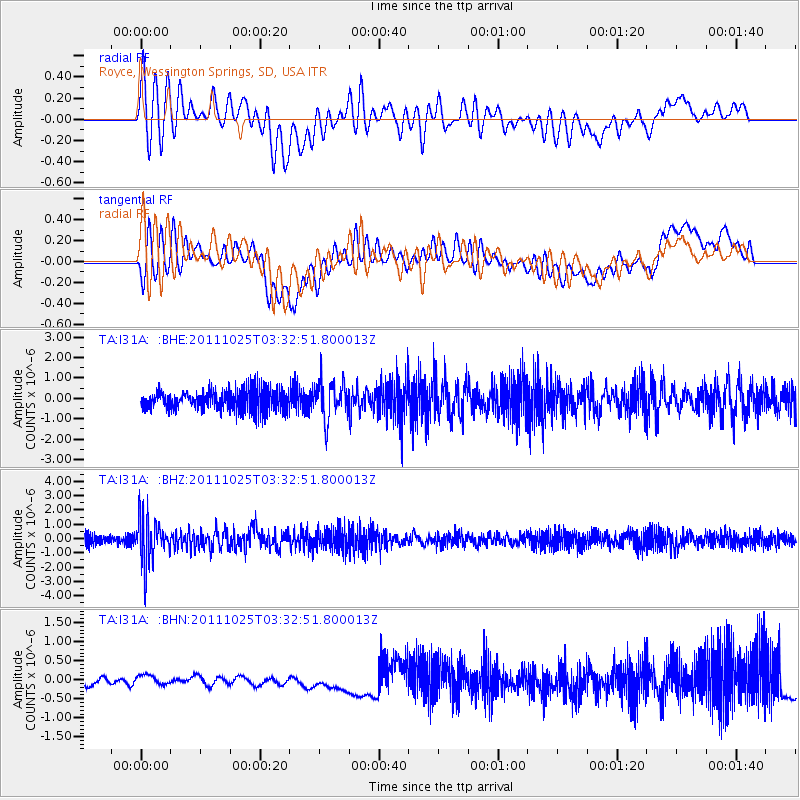
I31A Royce, Wessington Springs, SD, USA - Earthquake Result Viewer
*The percent match for this event was below the threshold and hence no stack was calculated.
| Earthquake location: |
Fox Islands, Aleutian Islands |
| Earthquake latitude/longitude: |
52.2/-171.8 |
| Earthquake time(UTC): |
2011/10/25 (298) 03:24:49 GMT |
| Earthquake Depth: |
38 km |
| Earthquake Magnitude: |
5.9 MB, 5.3 MS, 5.7 MW, 5.7 MW |
| Earthquake Catalog/Contributor: |
WHDF/NEIC |
|
| Network: |
TA USArray Transportable Network (new EarthScope stations) |
| Station: |
I31A Royce, Wessington Springs, SD, USA |
| Lat/Lon: |
44.03 N/98.54 W |
| Elevation: |
469 m |
|
| Distance: |
47.7 deg |
| Az: |
69.136 deg |
| Baz: |
307.055 deg |
| Ray Param: |
$rayparam |
*The percent match for this event was below the threshold and hence was not used in the summary stack. |
|
| Radial Match: |
76.72522 % |
| Radial Bump: |
400 |
| Transverse Match: |
69.373886 % |
| Transverse Bump: |
400 |
| SOD ConfigId: |
424168 |
| Insert Time: |
2012-02-16 09:09:21.358 +0000 |
| GWidth: |
2.5 |
| Max Bumps: |
400 |
| Tol: |
0.001 |
|
Signal To Noise
| Channel | StoN | STA | LTA |
| TA:I31A: :BHZ:20111025T03:32:51.800013Z | 5.209842 | 1.5775232E-6 | 3.0279674E-7 |
| TA:I31A: :BHN:20111025T03:32:51.800013Z | 0.78586984 | 1.2242934E-7 | 1.5578831E-7 |
| TA:I31A: :BHE:20111025T03:32:51.800013Z | 1.8430501 | 9.141956E-7 | 4.960232E-7 |
| Arrivals |
| Ps | |
| PpPs | |
| PsPs/PpSs | |


