J31A Geddes, SD, USA - Earthquake Result Viewer
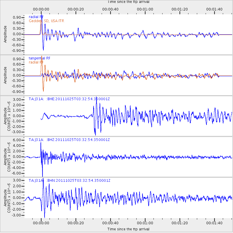
Earthquake location: Fox Islands, Aleutian Islands
Earthquake latitude/longitude: 52.2/-171.8
Earthquake time(UTC): 2011/10/25 (298) 03:24:49 GMT
Earthquake Depth: 38 km
Earthquake Magnitude: 5.9 MB, 5.3 MS, 5.7 MW, 5.7 MW
Earthquake Catalog/Contributor: WHDF/NEIC
Network: TA USArray Transportable Network (new EarthScope stations)
Station: J31A Geddes, SD, USA
Lat/Lon: 43.29 N/98.74 W
Elevation: 491 m
Distance: 48.0 deg
Az: 70.049 deg
Baz: 307.527 deg
Ray Param: 0.06955461
Estimated Moho Depth: 48.0 km
Estimated Crust Vp/Vs: 2.10
Assumed Crust Vp: 6.53 km/s
Estimated Crust Vs: 3.113 km/s
Estimated Crust Poisson's Ratio: 0.35
Radial Match: 89.441734 %
Radial Bump: 393
Transverse Match: 82.58481 %
Transverse Bump: 400
SOD ConfigId: 424168
Insert Time: 2012-02-16 09:10:35.258 +0000
GWidth: 2.5
Max Bumps: 400
Tol: 0.001

Signal To Noise

ChannelStoNSTALTA
TA:J31A: :BHZ:20111025T03:32:54.350001Z17.4318962.1242283E-61.2185872E-7
TA:J31A: :BHN:20111025T03:32:54.350001Z7.1358521.5965566E-62.2373735E-7
TA:J31A: :BHE:20111025T03:32:54.350001Z9.001661.7508297E-61.9450076E-7
Arrivals
Ps8.5 SECOND
PpPs22 SECOND
PsPs/PpSs30 SECOND