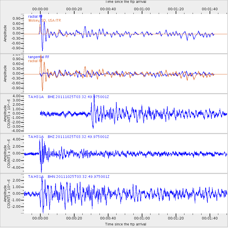
H31A Wolsey, SD, USA - Earthquake Result Viewer
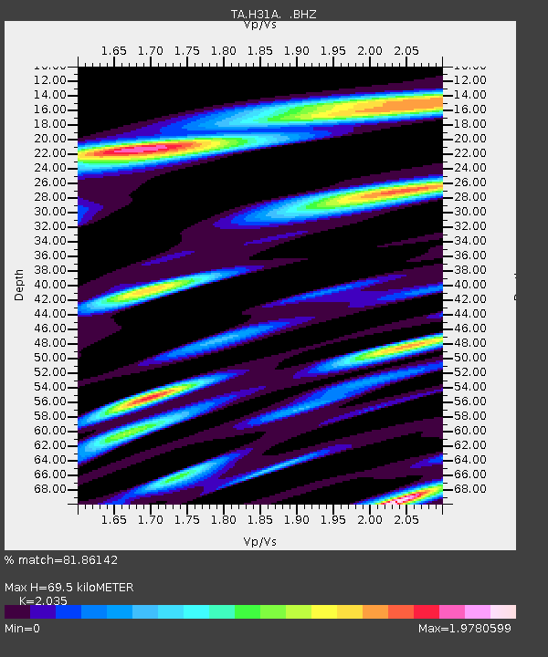
Earthquake location: Fox Islands, Aleutian Islands
Earthquake latitude/longitude: 52.2/-171.8
Earthquake time(UTC): 2011/10/25 (298) 03:24:49 GMT
Earthquake Depth: 38 km
Earthquake Magnitude: 5.9 MB, 5.3 MS, 5.7 MW, 5.7 MW
Earthquake Catalog/Contributor: WHDF/NEIC
Network: TA USArray Transportable Network (new EarthScope stations)
Station: H31A Wolsey, SD, USA
Lat/Lon: 44.48 N/98.48 W
Elevation: 415 m
Distance: 47.4 deg
Az: 68.614 deg
Baz: 306.744 deg
Ray Param: 0.06990605
Estimated Moho Depth: 69.5 km
Estimated Crust Vp/Vs: 2.04
Assumed Crust Vp: 6.53 km/s
Estimated Crust Vs: 3.209 km/s
Estimated Crust Poisson's Ratio: 0.34
Radial Match: 81.86142 %
Radial Bump: 390
Transverse Match: 81.11666 %
Transverse Bump: 400
SOD ConfigId: 424168
Insert Time: 2012-02-16 09:12:04.914 +0000
GWidth: 2.5
Max Bumps: 400
Tol: 0.001

Signal To Noise

ChannelStoNSTALTA
TA:H31A: :BHZ:20111025T03:32:49.975001Z10.350782.0871794E-62.0164467E-7
TA:H31A: :BHN:20111025T03:32:49.975001Z6.224721.3025842E-62.0925988E-7
TA:H31A: :BHE:20111025T03:32:49.975001Z6.31306271.7217046E-62.7272097E-7
Arrivals
Ps12 SECOND
PpPs31 SECOND
PsPs/PpSs42 SECOND