You are here: Home > Network List > TA - USArray Transportable Network (new EarthScope stations) Stations List
> Station C39A Grand Marais, MN, USA > Earthquake Result Viewer
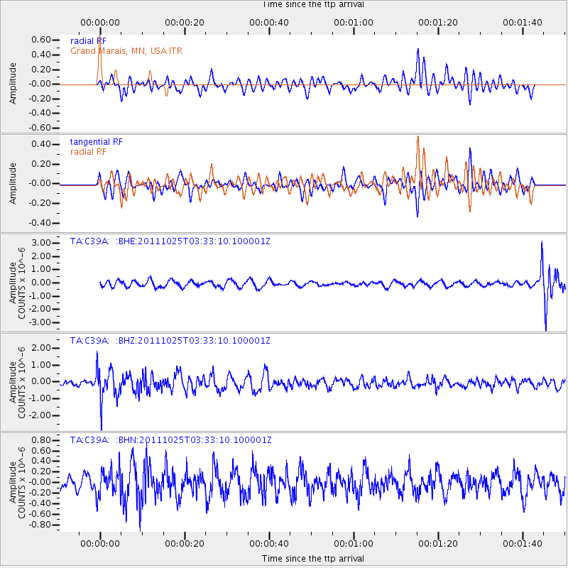
C39A Grand Marais, MN, USA - Earthquake Result Viewer
*The percent match for this event was below the threshold and hence no stack was calculated.
| Earthquake location: |
Fox Islands, Aleutian Islands |
| Earthquake latitude/longitude: |
52.2/-171.8 |
| Earthquake time(UTC): |
2011/10/25 (298) 03:24:49 GMT |
| Earthquake Depth: |
38 km |
| Earthquake Magnitude: |
5.9 MB, 5.3 MS, 5.7 MW, 5.7 MW |
| Earthquake Catalog/Contributor: |
WHDF/NEIC |
|
| Network: |
TA USArray Transportable Network (new EarthScope stations) |
| Station: |
C39A Grand Marais, MN, USA |
| Lat/Lon: |
47.82 N/90.13 W |
| Elevation: |
341 m |
|
| Distance: |
50.1 deg |
| Az: |
60.427 deg |
| Baz: |
307.348 deg |
| Ray Param: |
$rayparam |
*The percent match for this event was below the threshold and hence was not used in the summary stack. |
|
| Radial Match: |
64.96571 % |
| Radial Bump: |
400 |
| Transverse Match: |
56.41875 % |
| Transverse Bump: |
400 |
| SOD ConfigId: |
424168 |
| Insert Time: |
2012-02-16 09:14:32.760 +0000 |
| GWidth: |
2.5 |
| Max Bumps: |
400 |
| Tol: |
0.001 |
|
Signal To Noise
| Channel | StoN | STA | LTA |
| TA:C39A: :BHZ:20111025T03:33:10.100001Z | 4.187141 | 9.2759336E-7 | 2.2153384E-7 |
| TA:C39A: :BHN:20111025T03:33:10.100001Z | 1.7065518 | 2.456487E-7 | 1.4394446E-7 |
| TA:C39A: :BHE:20111025T03:33:10.100001Z | 1.1882762 | 2.7235444E-7 | 2.2920132E-7 |
| Arrivals |
| Ps | |
| PpPs | |
| PsPs/PpSs | |


