You are here: Home > Network List > TA - USArray Transportable Network (new EarthScope stations) Stations List
> Station V42A Cord, AR, USA > Earthquake Result Viewer
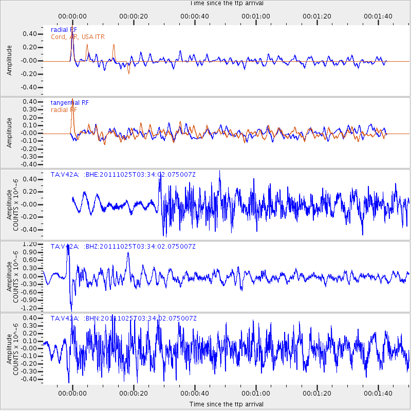
V42A Cord, AR, USA - Earthquake Result Viewer
*The percent match for this event was below the threshold and hence no stack was calculated.
| Earthquake location: |
Fox Islands, Aleutian Islands |
| Earthquake latitude/longitude: |
52.2/-171.8 |
| Earthquake time(UTC): |
2011/10/25 (298) 03:24:49 GMT |
| Earthquake Depth: |
38 km |
| Earthquake Magnitude: |
5.9 MB, 5.3 MS, 5.7 MW, 5.7 MW |
| Earthquake Catalog/Contributor: |
WHDF/NEIC |
|
| Network: |
TA USArray Transportable Network (new EarthScope stations) |
| Station: |
V42A Cord, AR, USA |
| Lat/Lon: |
35.81 N/91.39 W |
| Elevation: |
134 m |
|
| Distance: |
57.2 deg |
| Az: |
72.519 deg |
| Baz: |
313.708 deg |
| Ray Param: |
$rayparam |
*The percent match for this event was below the threshold and hence was not used in the summary stack. |
|
| Radial Match: |
72.40812 % |
| Radial Bump: |
336 |
| Transverse Match: |
59.608345 % |
| Transverse Bump: |
400 |
| SOD ConfigId: |
424168 |
| Insert Time: |
2012-02-16 09:26:06.715 +0000 |
| GWidth: |
2.5 |
| Max Bumps: |
400 |
| Tol: |
0.001 |
|
Signal To Noise
| Channel | StoN | STA | LTA |
| TA:V42A: :BHZ:20111025T03:34:02.075007Z | 4.011836 | 4.5311594E-7 | 1.12944775E-7 |
| TA:V42A: :BHN:20111025T03:34:02.075007Z | 2.176299 | 1.8076858E-7 | 8.306238E-8 |
| TA:V42A: :BHE:20111025T03:34:02.075007Z | 2.6176682 | 1.9671263E-7 | 7.5148044E-8 |
| Arrivals |
| Ps | |
| PpPs | |
| PsPs/PpSs | |


