You are here: Home > Network List > TA - USArray Transportable Network (new EarthScope stations) Stations List
> Station R42A Luebbering, MO, USA > Earthquake Result Viewer
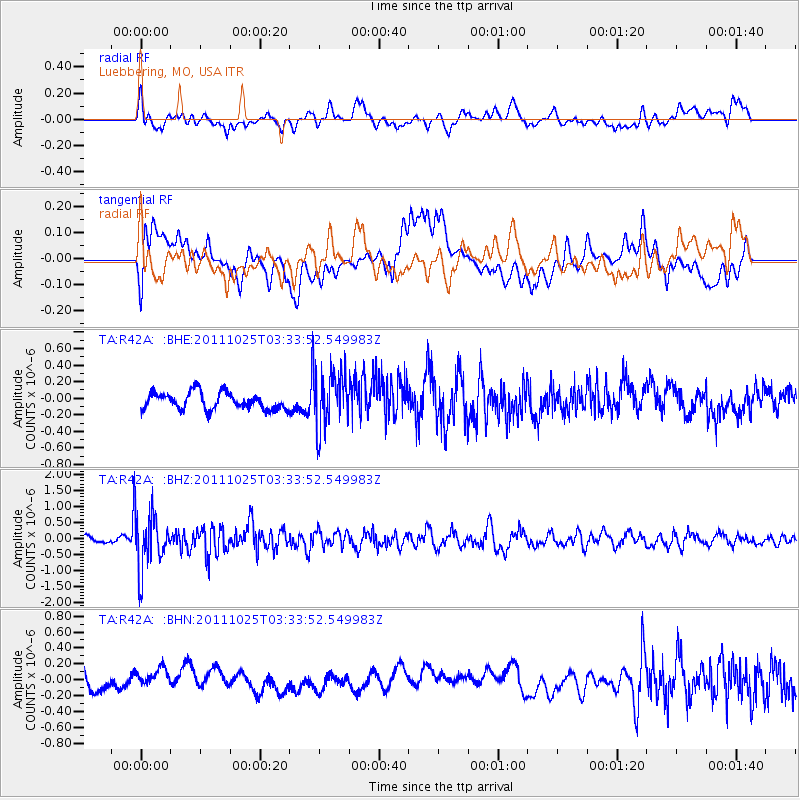
R42A Luebbering, MO, USA - Earthquake Result Viewer
*The percent match for this event was below the threshold and hence no stack was calculated.
| Earthquake location: |
Fox Islands, Aleutian Islands |
| Earthquake latitude/longitude: |
52.2/-171.8 |
| Earthquake time(UTC): |
2011/10/25 (298) 03:24:49 GMT |
| Earthquake Depth: |
38 km |
| Earthquake Magnitude: |
5.9 MB, 5.3 MS, 5.7 MW, 5.7 MW |
| Earthquake Catalog/Contributor: |
WHDF/NEIC |
|
| Network: |
TA USArray Transportable Network (new EarthScope stations) |
| Station: |
R42A Luebbering, MO, USA |
| Lat/Lon: |
38.28 N/90.79 W |
| Elevation: |
218 m |
|
| Distance: |
55.8 deg |
| Az: |
69.969 deg |
| Baz: |
312.658 deg |
| Ray Param: |
$rayparam |
*The percent match for this event was below the threshold and hence was not used in the summary stack. |
|
| Radial Match: |
60.945618 % |
| Radial Bump: |
400 |
| Transverse Match: |
56.508263 % |
| Transverse Bump: |
400 |
| SOD ConfigId: |
424168 |
| Insert Time: |
2012-02-16 09:28:56.434 +0000 |
| GWidth: |
2.5 |
| Max Bumps: |
400 |
| Tol: |
0.001 |
|
Signal To Noise
| Channel | StoN | STA | LTA |
| TA:R42A: :BHZ:20111025T03:33:52.549983Z | 5.3893347 | 8.3291866E-7 | 1.5454944E-7 |
| TA:R42A: :BHN:20111025T03:33:52.549983Z | 1.3914675 | 1.413511E-7 | 1.01584185E-7 |
| TA:R42A: :BHE:20111025T03:33:52.549983Z | 3.3725107 | 3.4192269E-7 | 1.01385204E-7 |
| Arrivals |
| Ps | |
| PpPs | |
| PsPs/PpSs | |


