You are here: Home > Network List > TA - USArray Transportable Network (new EarthScope stations) Stations List
> Station P44A Sand Creek, Windsor, IL, USA > Earthquake Result Viewer
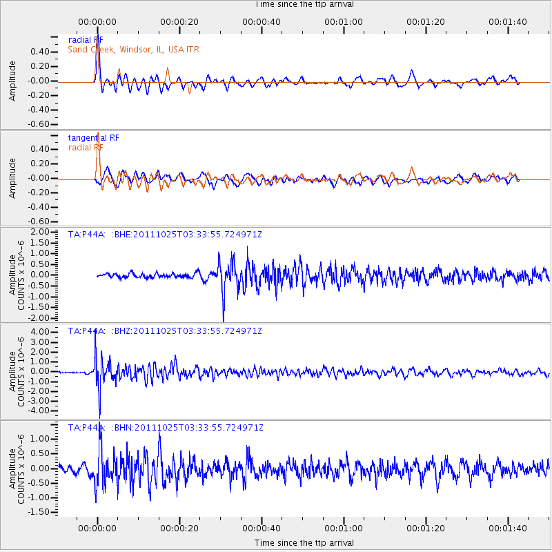
P44A Sand Creek, Windsor, IL, USA - Earthquake Result Viewer
*The percent match for this event was below the threshold and hence no stack was calculated.
| Earthquake location: |
Fox Islands, Aleutian Islands |
| Earthquake latitude/longitude: |
52.2/-171.8 |
| Earthquake time(UTC): |
2011/10/25 (298) 03:24:49 GMT |
| Earthquake Depth: |
38 km |
| Earthquake Magnitude: |
5.9 MB, 5.3 MS, 5.7 MW, 5.7 MW |
| Earthquake Catalog/Contributor: |
WHDF/NEIC |
|
| Network: |
TA USArray Transportable Network (new EarthScope stations) |
| Station: |
P44A Sand Creek, Windsor, IL, USA |
| Lat/Lon: |
39.47 N/88.62 W |
| Elevation: |
195 m |
|
| Distance: |
56.3 deg |
| Az: |
67.532 deg |
| Baz: |
312.656 deg |
| Ray Param: |
$rayparam |
*The percent match for this event was below the threshold and hence was not used in the summary stack. |
|
| Radial Match: |
71.40027 % |
| Radial Bump: |
360 |
| Transverse Match: |
71.48688 % |
| Transverse Bump: |
400 |
| SOD ConfigId: |
424168 |
| Insert Time: |
2012-02-16 09:30:40.374 +0000 |
| GWidth: |
2.5 |
| Max Bumps: |
400 |
| Tol: |
0.001 |
|
Signal To Noise
| Channel | StoN | STA | LTA |
| TA:P44A: :BHZ:20111025T03:33:55.724971Z | 15.527661 | 1.5256362E-6 | 9.8252805E-8 |
| TA:P44A: :BHN:20111025T03:33:55.724971Z | 3.9868338 | 5.9690393E-7 | 1.4971879E-7 |
| TA:P44A: :BHE:20111025T03:33:55.724971Z | 7.3051076 | 6.8773716E-7 | 9.41447E-8 |
| Arrivals |
| Ps | |
| PpPs | |
| PsPs/PpSs | |


