You are here: Home > Network List > TA - USArray Transportable Network (new EarthScope stations) Stations List
> Station J04D Umpqua National Forest, Toketee, OR, USA > Earthquake Result Viewer
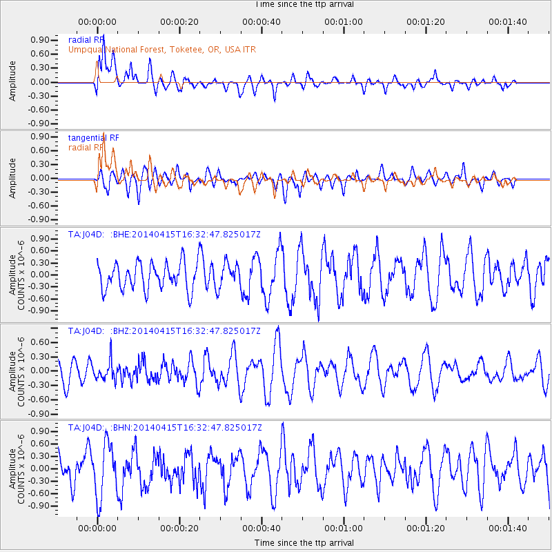
J04D Umpqua National Forest, Toketee, OR, USA - Earthquake Result Viewer
*The percent match for this event was below the threshold and hence no stack was calculated.
| Earthquake location: |
Near Coast Of Northern Chile |
| Earthquake latitude/longitude: |
-20.2/-70.7 |
| Earthquake time(UTC): |
2014/04/15 (105) 16:21:17 GMT |
| Earthquake Depth: |
18 km |
| Earthquake Magnitude: |
5.1 MW |
| Earthquake Catalog/Contributor: |
ISC/ISC |
|
| Network: |
TA USArray Transportable Network (new EarthScope stations) |
| Station: |
J04D Umpqua National Forest, Toketee, OR, USA |
| Lat/Lon: |
43.24 N/122.11 W |
| Elevation: |
1948 m |
|
| Distance: |
78.8 deg |
| Az: |
324.41 deg |
| Baz: |
131.58 deg |
| Ray Param: |
$rayparam |
*The percent match for this event was below the threshold and hence was not used in the summary stack. |
|
| Radial Match: |
62.09008 % |
| Radial Bump: |
400 |
| Transverse Match: |
34.531578 % |
| Transverse Bump: |
400 |
| SOD ConfigId: |
3390531 |
| Insert Time: |
2019-04-11 10:19:28.980 +0000 |
| GWidth: |
2.5 |
| Max Bumps: |
400 |
| Tol: |
0.001 |
|
Signal To Noise
| Channel | StoN | STA | LTA |
| TA:J04D: :BHZ:20140415T16:32:47.825017Z | 0.72489923 | 1.9612193E-7 | 2.7055063E-7 |
| TA:J04D: :BHN:20140415T16:32:47.825017Z | 1.8240052 | 6.625687E-7 | 3.6324934E-7 |
| TA:J04D: :BHE:20140415T16:32:47.825017Z | 0.9246434 | 3.085881E-7 | 3.3373743E-7 |
| Arrivals |
| Ps | |
| PpPs | |
| PsPs/PpSs | |


