You are here: Home > Network List > UW - Pacific Northwest Regional Seismic Network Stations List
> Station TAKO Tahkenitch, OR CREST BB SMO > Earthquake Result Viewer
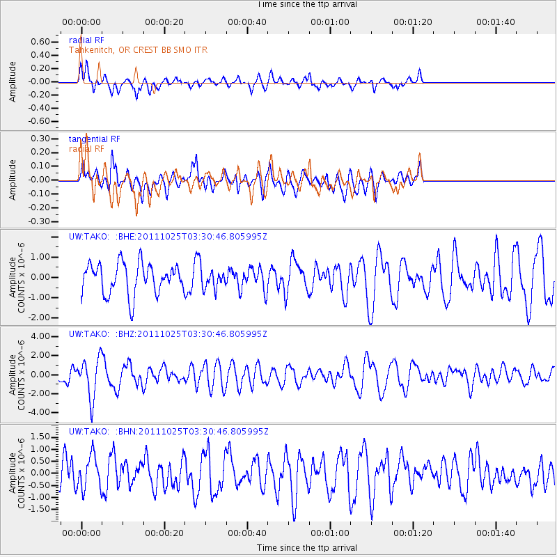
TAKO Tahkenitch, OR CREST BB SMO - Earthquake Result Viewer
*The percent match for this event was below the threshold and hence no stack was calculated.
| Earthquake location: |
Fox Islands, Aleutian Islands |
| Earthquake latitude/longitude: |
52.2/-171.8 |
| Earthquake time(UTC): |
2011/10/25 (298) 03:24:49 GMT |
| Earthquake Depth: |
38 km |
| Earthquake Magnitude: |
5.9 MB, 5.3 MS, 5.7 MW, 5.7 MW |
| Earthquake Catalog/Contributor: |
WHDF/NEIC |
|
| Network: |
UW Pacific Northwest Regional Seismic Network |
| Station: |
TAKO Tahkenitch, OR CREST BB SMO |
| Lat/Lon: |
43.74 N/124.08 W |
| Elevation: |
46 m |
|
| Distance: |
32.5 deg |
| Az: |
85.677 deg |
| Baz: |
302.051 deg |
| Ray Param: |
$rayparam |
*The percent match for this event was below the threshold and hence was not used in the summary stack. |
|
| Radial Match: |
57.91477 % |
| Radial Bump: |
400 |
| Transverse Match: |
55.292213 % |
| Transverse Bump: |
400 |
| SOD ConfigId: |
424168 |
| Insert Time: |
2012-02-16 09:36:44.821 +0000 |
| GWidth: |
2.5 |
| Max Bumps: |
400 |
| Tol: |
0.001 |
|
Signal To Noise
| Channel | StoN | STA | LTA |
| UW:TAKO: :BHZ:20111025T03:30:46.805995Z | 3.5213563 | 2.124698E-6 | 6.033749E-7 |
| UW:TAKO: :BHN:20111025T03:30:46.805995Z | 1.1978995 | 6.910517E-7 | 5.7688624E-7 |
| UW:TAKO: :BHE:20111025T03:30:46.805995Z | 0.55070835 | 4.168844E-7 | 7.569967E-7 |
| Arrivals |
| Ps | |
| PpPs | |
| PsPs/PpSs | |


