You are here: Home > Network List > UW - Pacific Northwest Regional Seismic Network Stations List
> Station MRBL Marblemount, WA, USA > Earthquake Result Viewer
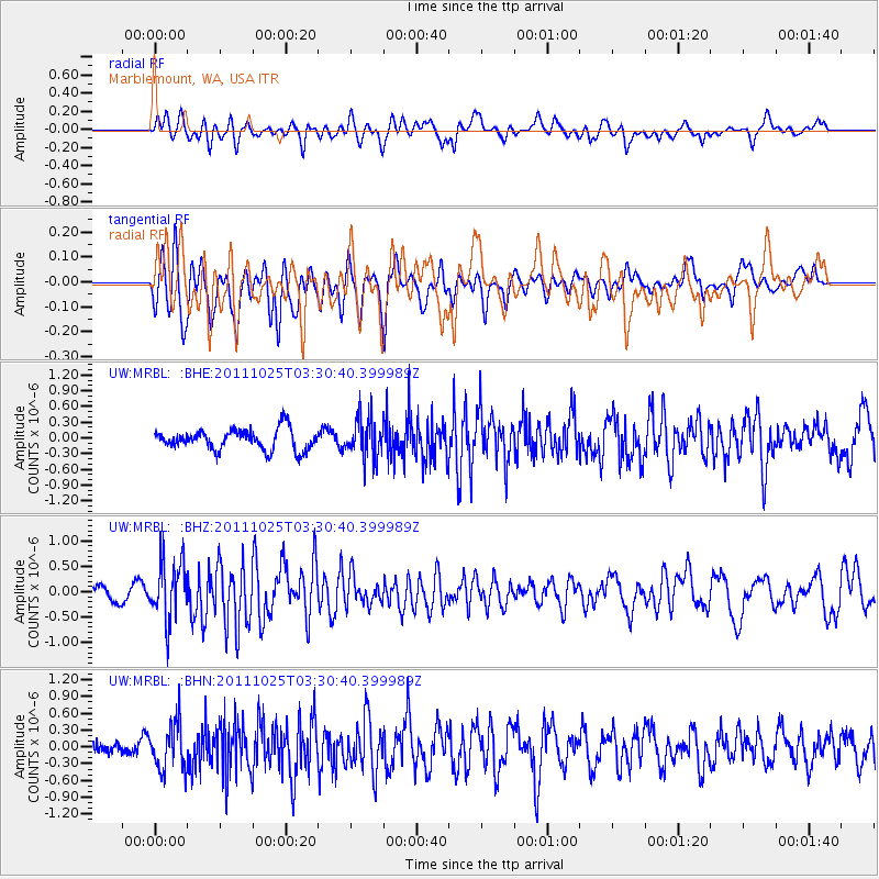
MRBL Marblemount, WA, USA - Earthquake Result Viewer
*The percent match for this event was below the threshold and hence no stack was calculated.
| Earthquake location: |
Fox Islands, Aleutian Islands |
| Earthquake latitude/longitude: |
52.2/-171.8 |
| Earthquake time(UTC): |
2011/10/25 (298) 03:24:49 GMT |
| Earthquake Depth: |
38 km |
| Earthquake Magnitude: |
5.9 MB, 5.3 MS, 5.7 MW, 5.7 MW |
| Earthquake Catalog/Contributor: |
WHDF/NEIC |
|
| Network: |
UW Pacific Northwest Regional Seismic Network |
| Station: |
MRBL Marblemount, WA, USA |
| Lat/Lon: |
48.52 N/121.48 W |
| Elevation: |
75 m |
|
| Distance: |
31.8 deg |
| Az: |
76.181 deg |
| Baz: |
295.877 deg |
| Ray Param: |
$rayparam |
*The percent match for this event was below the threshold and hence was not used in the summary stack. |
|
| Radial Match: |
57.75651 % |
| Radial Bump: |
400 |
| Transverse Match: |
58.270622 % |
| Transverse Bump: |
400 |
| SOD ConfigId: |
424168 |
| Insert Time: |
2012-02-16 09:37:10.791 +0000 |
| GWidth: |
2.5 |
| Max Bumps: |
400 |
| Tol: |
0.001 |
|
Signal To Noise
| Channel | StoN | STA | LTA |
| UW:MRBL: :BHZ:20111025T03:30:40.399989Z | 4.164847 | 5.653434E-7 | 1.357417E-7 |
| UW:MRBL: :BHN:20111025T03:30:40.399989Z | 3.013104 | 4.1759293E-7 | 1.3859227E-7 |
| UW:MRBL: :BHE:20111025T03:30:40.399989Z | 1.9192041 | 3.8094475E-7 | 1.9849101E-7 |
| Arrivals |
| Ps | |
| PpPs | |
| PsPs/PpSs | |


