You are here: Home > Network List > TA - USArray Transportable Network (new EarthScope stations) Stations List
> Station S37A Fort Scott, KS, USA > Earthquake Result Viewer
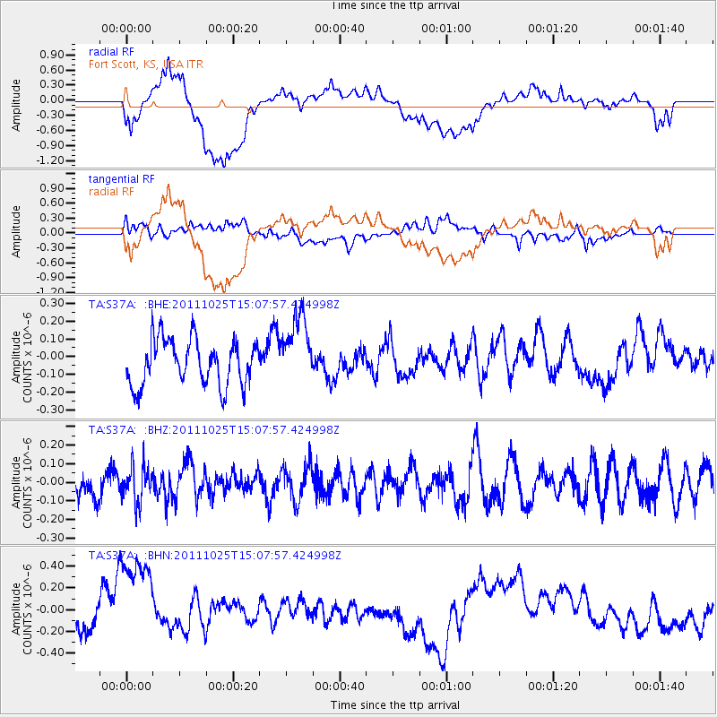
S37A Fort Scott, KS, USA - Earthquake Result Viewer
*The percent match for this event was below the threshold and hence no stack was calculated.
| Earthquake location: |
Turkey |
| Earthquake latitude/longitude: |
38.8/43.6 |
| Earthquake time(UTC): |
2011/10/25 (298) 14:55:08 GMT |
| Earthquake Depth: |
14 km |
| Earthquake Magnitude: |
5.7 MB, 5.2 MS, 5.6 MW, 5.3 MW |
| Earthquake Catalog/Contributor: |
WHDF/NEIC |
|
| Network: |
TA USArray Transportable Network (new EarthScope stations) |
| Station: |
S37A Fort Scott, KS, USA |
| Lat/Lon: |
37.76 N/94.83 W |
| Elevation: |
260 m |
|
| Distance: |
94.7 deg |
| Az: |
328.164 deg |
| Baz: |
31.33 deg |
| Ray Param: |
$rayparam |
*The percent match for this event was below the threshold and hence was not used in the summary stack. |
|
| Radial Match: |
42.27793 % |
| Radial Bump: |
400 |
| Transverse Match: |
39.15726 % |
| Transverse Bump: |
400 |
| SOD ConfigId: |
424168 |
| Insert Time: |
2012-02-16 09:47:46.511 +0000 |
| GWidth: |
2.5 |
| Max Bumps: |
400 |
| Tol: |
0.001 |
|
Signal To Noise
| Channel | StoN | STA | LTA |
| TA:S37A: :BHZ:20111025T15:07:57.424998Z | 1.174998 | 9.478943E-8 | 8.067198E-8 |
| TA:S37A: :BHN:20111025T15:07:57.424998Z | 2.2309568 | 5.3387504E-7 | 2.3930318E-7 |
| TA:S37A: :BHE:20111025T15:07:57.424998Z | 1.5630573 | 2.0059437E-7 | 1.2833462E-7 |
| Arrivals |
| Ps | |
| PpPs | |
| PsPs/PpSs | |


