
HYB Hyderabad, India - Earthquake Result Viewer
| ||||||||||||||||||
| ||||||||||||||||||
| ||||||||||||||||||
|
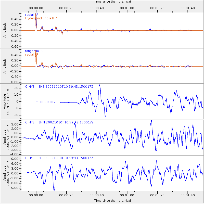
Signal To Noise
| Channel | StoN | STA | LTA |
| G:HYB: :BHN:20021010T10:59:43.150017Z | 7.6138988 | 4.623741E-7 | 6.0727636E-8 |
| G:HYB: :BHE:20021010T10:59:43.150017Z | 9.455098 | 1.7358205E-6 | 1.8358567E-7 |
| G:HYB: :BHZ:20021010T10:59:43.150017Z | 11.666744 | 3.6692913E-6 | 3.1450858E-7 |
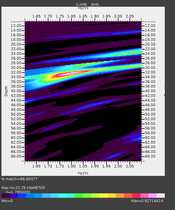
| Arrivals | |
| Ps | 4.2 SECOND |
| PpPs | 13 SECOND |
| PsPs/PpSs | 17 SECOND |

