You are here: Home > Network List > CI - Caltech Regional Seismic Network Stations List
> Station HEC Hector, Baker, CA, USA > Earthquake Result Viewer
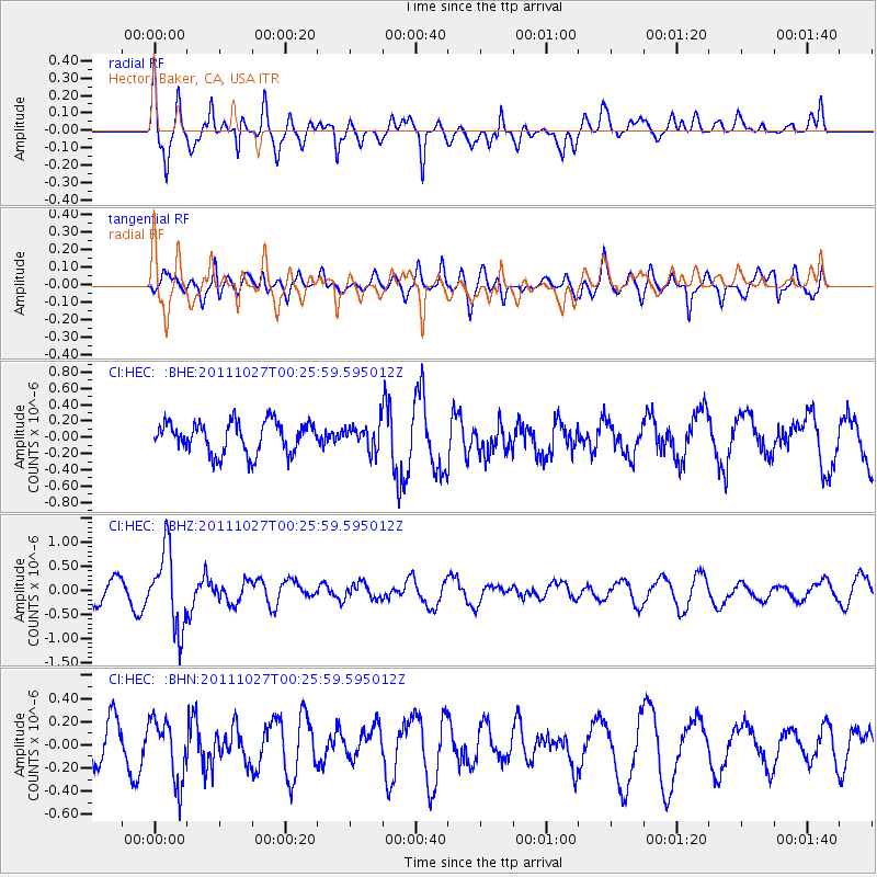
HEC Hector, Baker, CA, USA - Earthquake Result Viewer
*The percent match for this event was below the threshold and hence no stack was calculated.
| Earthquake location: |
Fiji Islands Region |
| Earthquake latitude/longitude: |
-17.9/-179.5 |
| Earthquake time(UTC): |
2011/10/27 (300) 00:15:24 GMT |
| Earthquake Depth: |
603 km |
| Earthquake Magnitude: |
6.0 MW, 5.3 MB, 6.0 MW |
| Earthquake Catalog/Contributor: |
WHDF/NEIC |
|
| Network: |
CI Caltech Regional Seismic Network |
| Station: |
HEC Hector, Baker, CA, USA |
| Lat/Lon: |
34.83 N/116.33 W |
| Elevation: |
920 m |
|
| Distance: |
79.7 deg |
| Az: |
48.273 deg |
| Baz: |
239.729 deg |
| Ray Param: |
$rayparam |
*The percent match for this event was below the threshold and hence was not used in the summary stack. |
|
| Radial Match: |
62.38276 % |
| Radial Bump: |
400 |
| Transverse Match: |
43.00049 % |
| Transverse Bump: |
400 |
| SOD ConfigId: |
424168 |
| Insert Time: |
2012-02-16 10:06:50.294 +0000 |
| GWidth: |
2.5 |
| Max Bumps: |
400 |
| Tol: |
0.001 |
|
Signal To Noise
| Channel | StoN | STA | LTA |
| CI:HEC: :BHZ:20111027T00:25:59.595012Z | 3.5995278 | 8.039492E-7 | 2.2334852E-7 |
| CI:HEC: :BHN:20111027T00:25:59.595012Z | 1.4215962 | 2.6861238E-7 | 1.8895125E-7 |
| CI:HEC: :BHE:20111027T00:25:59.595012Z | 0.8020937 | 1.5360986E-7 | 1.9151113E-7 |
| Arrivals |
| Ps | |
| PpPs | |
| PsPs/PpSs | |


