You are here: Home > Network List > CI - Caltech Regional Seismic Network Stations List
> Station GMR Granite Mountains Research Center > Earthquake Result Viewer
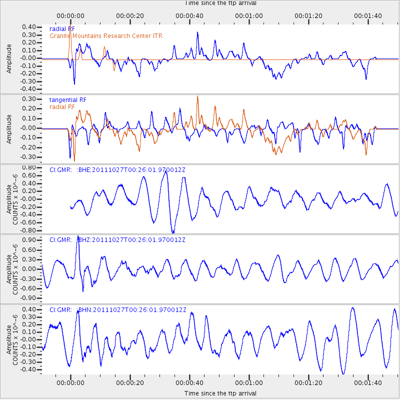
GMR Granite Mountains Research Center - Earthquake Result Viewer
*The percent match for this event was below the threshold and hence no stack was calculated.
| Earthquake location: |
Fiji Islands Region |
| Earthquake latitude/longitude: |
-17.9/-179.5 |
| Earthquake time(UTC): |
2011/10/27 (300) 00:15:24 GMT |
| Earthquake Depth: |
603 km |
| Earthquake Magnitude: |
6.0 MW, 5.3 MB, 6.0 MW |
| Earthquake Catalog/Contributor: |
WHDF/NEIC |
|
| Network: |
CI Caltech Regional Seismic Network |
| Station: |
GMR Granite Mountains Research Center |
| Lat/Lon: |
34.78 N/115.66 W |
| Elevation: |
1326 m |
|
| Distance: |
80.1 deg |
| Az: |
48.595 deg |
| Baz: |
240.169 deg |
| Ray Param: |
$rayparam |
*The percent match for this event was below the threshold and hence was not used in the summary stack. |
|
| Radial Match: |
65.403656 % |
| Radial Bump: |
400 |
| Transverse Match: |
67.413414 % |
| Transverse Bump: |
400 |
| SOD ConfigId: |
424168 |
| Insert Time: |
2012-02-16 10:08:18.864 +0000 |
| GWidth: |
2.5 |
| Max Bumps: |
400 |
| Tol: |
0.001 |
|
Signal To Noise
| Channel | StoN | STA | LTA |
| CI:GMR: :BHZ:20111027T00:26:01.970012Z | 1.2834682 | 4.5401532E-7 | 3.53741E-7 |
| CI:GMR: :BHN:20111027T00:26:01.970012Z | 1.0827634 | 2.4893126E-7 | 2.2990365E-7 |
| CI:GMR: :BHE:20111027T00:26:01.970012Z | 2.4887316 | 5.435487E-7 | 2.1840391E-7 |
| Arrivals |
| Ps | |
| PpPs | |
| PsPs/PpSs | |


