You are here: Home > Network List > IW - Intermountain West Stations List
> Station PLID Pearl Lake, Idaho, USA > Earthquake Result Viewer
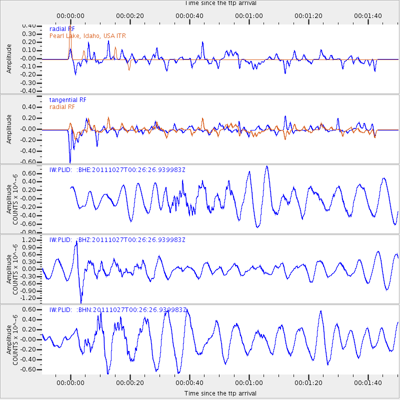
PLID Pearl Lake, Idaho, USA - Earthquake Result Viewer
*The percent match for this event was below the threshold and hence no stack was calculated.
| Earthquake location: |
Fiji Islands Region |
| Earthquake latitude/longitude: |
-17.9/-179.5 |
| Earthquake time(UTC): |
2011/10/27 (300) 00:15:24 GMT |
| Earthquake Depth: |
603 km |
| Earthquake Magnitude: |
6.0 MW, 5.3 MB, 6.0 MW |
| Earthquake Catalog/Contributor: |
WHDF/NEIC |
|
| Network: |
IW Intermountain West |
| Station: |
PLID Pearl Lake, Idaho, USA |
| Lat/Lon: |
45.09 N/116.00 W |
| Elevation: |
2164 m |
|
| Distance: |
85.2 deg |
| Az: |
39.525 deg |
| Baz: |
238.787 deg |
| Ray Param: |
$rayparam |
*The percent match for this event was below the threshold and hence was not used in the summary stack. |
|
| Radial Match: |
55.48987 % |
| Radial Bump: |
400 |
| Transverse Match: |
58.369183 % |
| Transverse Bump: |
388 |
| SOD ConfigId: |
424168 |
| Insert Time: |
2012-02-16 10:10:10.429 +0000 |
| GWidth: |
2.5 |
| Max Bumps: |
400 |
| Tol: |
0.001 |
|
Signal To Noise
| Channel | StoN | STA | LTA |
| IW:PLID: :BHZ:20111027T00:26:26.939983Z | 2.658205 | 6.9244123E-7 | 2.6049204E-7 |
| IW:PLID: :BHN:20111027T00:26:26.939983Z | 0.7249718 | 1.5506104E-7 | 2.1388563E-7 |
| IW:PLID: :BHE:20111027T00:26:26.939983Z | 0.86798614 | 1.8090489E-7 | 2.084191E-7 |
| Arrivals |
| Ps | |
| PpPs | |
| PsPs/PpSs | |


