You are here: Home > Network List > TA - USArray Transportable Network (new EarthScope stations) Stations List
> Station BGNE Belgrade, NE, USA > Earthquake Result Viewer
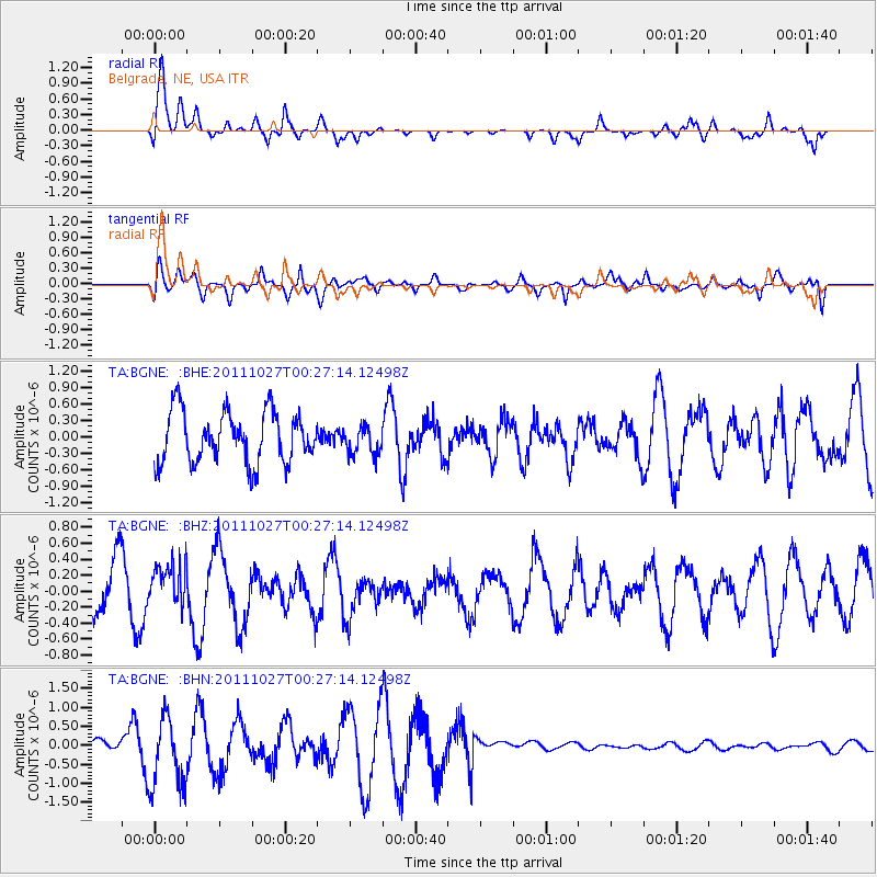
BGNE Belgrade, NE, USA - Earthquake Result Viewer
*The percent match for this event was below the threshold and hence no stack was calculated.
| Earthquake location: |
Fiji Islands Region |
| Earthquake latitude/longitude: |
-17.9/-179.5 |
| Earthquake time(UTC): |
2011/10/27 (300) 00:15:24 GMT |
| Earthquake Depth: |
603 km |
| Earthquake Magnitude: |
6.0 MW, 5.3 MB, 6.0 MW |
| Earthquake Catalog/Contributor: |
WHDF/NEIC |
|
| Network: |
TA USArray Transportable Network (new EarthScope stations) |
| Station: |
BGNE Belgrade, NE, USA |
| Lat/Lon: |
41.41 N/98.15 W |
| Elevation: |
573 m |
|
| Distance: |
95.4 deg |
| Az: |
48.336 deg |
| Baz: |
250.988 deg |
| Ray Param: |
$rayparam |
*The percent match for this event was below the threshold and hence was not used in the summary stack. |
|
| Radial Match: |
66.64798 % |
| Radial Bump: |
400 |
| Transverse Match: |
56.529022 % |
| Transverse Bump: |
400 |
| SOD ConfigId: |
424168 |
| Insert Time: |
2012-02-16 10:11:50.128 +0000 |
| GWidth: |
2.5 |
| Max Bumps: |
400 |
| Tol: |
0.001 |
|
Signal To Noise
| Channel | StoN | STA | LTA |
| TA:BGNE: :BHZ:20111027T00:27:14.12498Z | 0.7205217 | 2.6164793E-7 | 3.631368E-7 |
| TA:BGNE: :BHN:20111027T00:27:14.12498Z | 10.729195 | 9.56939E-7 | 8.919019E-8 |
| TA:BGNE: :BHE:20111027T00:27:14.12498Z | 0.5492249 | 2.5778144E-7 | 4.6935497E-7 |
| Arrivals |
| Ps | |
| PpPs | |
| PsPs/PpSs | |


