You are here: Home > Network List > TA - USArray Transportable Network (new EarthScope stations) Stations List
> Station H04D Lebanon, OR, USA > Earthquake Result Viewer
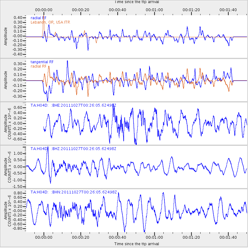
H04D Lebanon, OR, USA - Earthquake Result Viewer
*The percent match for this event was below the threshold and hence no stack was calculated.
| Earthquake location: |
Fiji Islands Region |
| Earthquake latitude/longitude: |
-17.9/-179.5 |
| Earthquake time(UTC): |
2011/10/27 (300) 00:15:24 GMT |
| Earthquake Depth: |
603 km |
| Earthquake Magnitude: |
6.0 MW, 5.3 MB, 6.0 MW |
| Earthquake Catalog/Contributor: |
WHDF/NEIC |
|
| Network: |
TA USArray Transportable Network (new EarthScope stations) |
| Station: |
H04D Lebanon, OR, USA |
| Lat/Lon: |
44.52 N/122.74 W |
| Elevation: |
284 m |
|
| Distance: |
80.9 deg |
| Az: |
37.316 deg |
| Baz: |
233.783 deg |
| Ray Param: |
$rayparam |
*The percent match for this event was below the threshold and hence was not used in the summary stack. |
|
| Radial Match: |
49.937695 % |
| Radial Bump: |
400 |
| Transverse Match: |
63.670185 % |
| Transverse Bump: |
400 |
| SOD ConfigId: |
424168 |
| Insert Time: |
2012-02-16 10:14:33.797 +0000 |
| GWidth: |
2.5 |
| Max Bumps: |
400 |
| Tol: |
0.001 |
|
Signal To Noise
| Channel | StoN | STA | LTA |
| TA:H04D: :BHZ:20111027T00:26:05.62498Z | 2.5303864 | 7.2283655E-7 | 2.856625E-7 |
| TA:H04D: :BHN:20111027T00:26:05.62498Z | 0.9452281 | 3.178248E-7 | 3.3624138E-7 |
| TA:H04D: :BHE:20111027T00:26:05.62498Z | 0.7483513 | 1.818578E-7 | 2.4301127E-7 |
| Arrivals |
| Ps | |
| PpPs | |
| PsPs/PpSs | |


