You are here: Home > Network List > TA - USArray Transportable Network (new EarthScope stations) Stations List
> Station L04D Klamath Falls, OR, USA > Earthquake Result Viewer
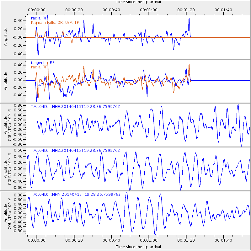
L04D Klamath Falls, OR, USA - Earthquake Result Viewer
*The percent match for this event was below the threshold and hence no stack was calculated.
| Earthquake location: |
New Ireland Region, P.N.G. |
| Earthquake latitude/longitude: |
-5.7/153.8 |
| Earthquake time(UTC): |
2014/04/15 (105) 19:16:17 GMT |
| Earthquake Depth: |
47 km |
| Earthquake Magnitude: |
5.3 MW |
| Earthquake Catalog/Contributor: |
ISC/ISC |
|
| Network: |
TA USArray Transportable Network (new EarthScope stations) |
| Station: |
L04D Klamath Falls, OR, USA |
| Lat/Lon: |
42.22 N/122.30 W |
| Elevation: |
1437 m |
|
| Distance: |
89.2 deg |
| Az: |
47.616 deg |
| Baz: |
261.725 deg |
| Ray Param: |
$rayparam |
*The percent match for this event was below the threshold and hence was not used in the summary stack. |
|
| Radial Match: |
54.050007 % |
| Radial Bump: |
400 |
| Transverse Match: |
71.07572 % |
| Transverse Bump: |
400 |
| SOD ConfigId: |
3390531 |
| Insert Time: |
2019-04-11 10:26:37.959 +0000 |
| GWidth: |
2.5 |
| Max Bumps: |
400 |
| Tol: |
0.001 |
|
Signal To Noise
| Channel | StoN | STA | LTA |
| TA:L04D: :HHZ:20140415T19:28:36.759976Z | 1.3282604 | 2.903245E-7 | 2.1857498E-7 |
| TA:L04D: :HHN:20140415T19:28:36.759976Z | 0.7423604 | 2.720694E-7 | 3.6649234E-7 |
| TA:L04D: :HHE:20140415T19:28:36.759976Z | 0.651011 | 1.4571862E-7 | 2.2383435E-7 |
| Arrivals |
| Ps | |
| PpPs | |
| PsPs/PpSs | |


