You are here: Home > Network List > G - GEOSCOPE Stations List
> Station IVI Ivittuut, Greenland > Earthquake Result Viewer
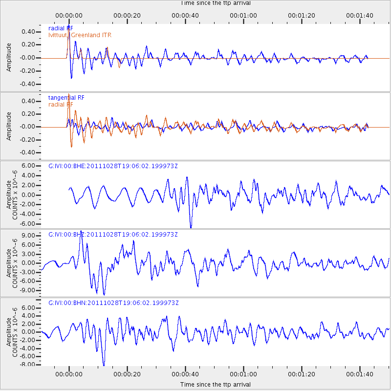
IVI Ivittuut, Greenland - Earthquake Result Viewer
*The percent match for this event was below the threshold and hence no stack was calculated.
| Earthquake location: |
Near Coast Of Peru |
| Earthquake latitude/longitude: |
-14.4/-76.0 |
| Earthquake time(UTC): |
2011/10/28 (301) 18:54:34 GMT |
| Earthquake Depth: |
24 km |
| Earthquake Magnitude: |
6.5 MB, 6.9 MS, 6.9 MW, 6.9 MW |
| Earthquake Catalog/Contributor: |
WHDF/NEIC |
|
| Network: |
G GEOSCOPE |
| Station: |
IVI Ivittuut, Greenland |
| Lat/Lon: |
61.21 N/48.17 W |
| Elevation: |
15 m |
|
| Distance: |
78.6 deg |
| Az: |
13.317 deg |
| Baz: |
207.446 deg |
| Ray Param: |
$rayparam |
*The percent match for this event was below the threshold and hence was not used in the summary stack. |
|
| Radial Match: |
74.54316 % |
| Radial Bump: |
400 |
| Transverse Match: |
43.994778 % |
| Transverse Bump: |
400 |
| SOD ConfigId: |
424168 |
| Insert Time: |
2012-02-16 10:35:26.255 +0000 |
| GWidth: |
2.5 |
| Max Bumps: |
400 |
| Tol: |
0.001 |
|
Signal To Noise
| Channel | StoN | STA | LTA |
| G:IVI:00:BHZ:20111028T19:06:02.199973Z | 3.6230962 | 4.332331E-6 | 1.1957537E-6 |
| G:IVI:00:BHN:20111028T19:06:02.199973Z | 1.8392812 | 1.5152738E-6 | 8.238402E-7 |
| G:IVI:00:BHE:20111028T19:06:02.199973Z | 1.126705 | 1.4224773E-6 | 1.2625109E-6 |
| Arrivals |
| Ps | |
| PpPs | |
| PsPs/PpSs | |


