You are here: Home > Network List > IW - Intermountain West Stations List
> Station DLMT Dillon, Montana, USA > Earthquake Result Viewer
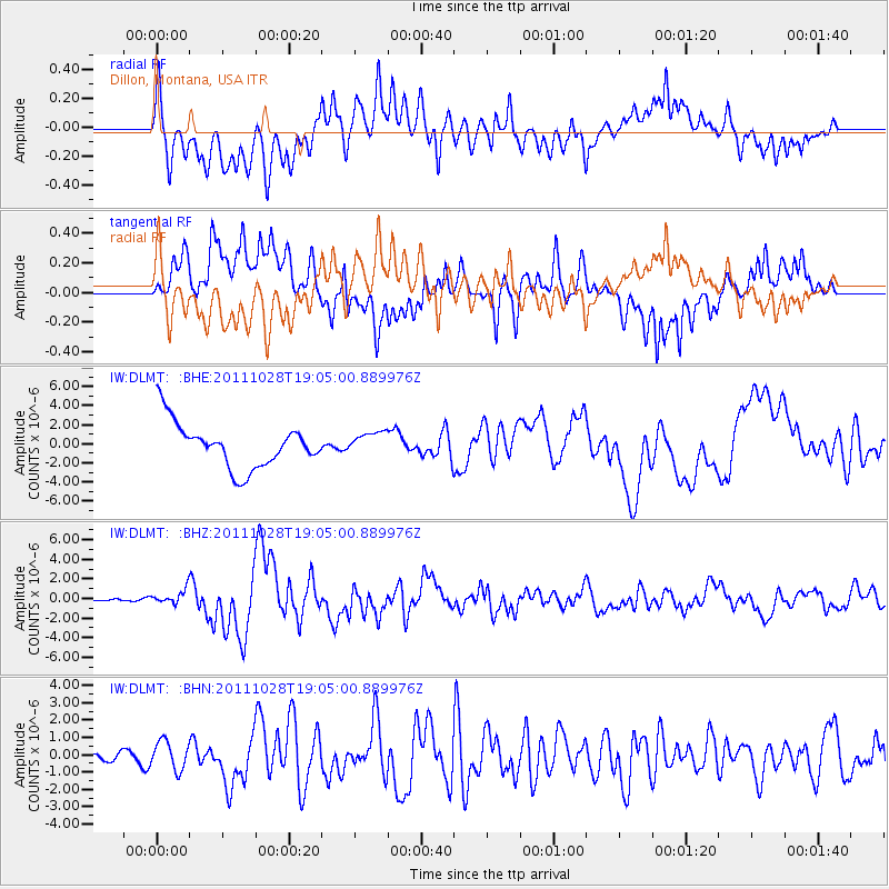
DLMT Dillon, Montana, USA - Earthquake Result Viewer
*The percent match for this event was below the threshold and hence no stack was calculated.
| Earthquake location: |
Near Coast Of Peru |
| Earthquake latitude/longitude: |
-14.4/-76.0 |
| Earthquake time(UTC): |
2011/10/28 (301) 18:54:34 GMT |
| Earthquake Depth: |
24 km |
| Earthquake Magnitude: |
6.5 MB, 6.9 MS, 6.9 MW, 6.9 MW |
| Earthquake Catalog/Contributor: |
WHDF/NEIC |
|
| Network: |
IW Intermountain West |
| Station: |
DLMT Dillon, Montana, USA |
| Lat/Lon: |
45.36 N/112.60 W |
| Elevation: |
1569 m |
|
| Distance: |
68.1 deg |
| Az: |
333.048 deg |
| Baz: |
141.475 deg |
| Ray Param: |
$rayparam |
*The percent match for this event was below the threshold and hence was not used in the summary stack. |
|
| Radial Match: |
71.461754 % |
| Radial Bump: |
400 |
| Transverse Match: |
70.280045 % |
| Transverse Bump: |
400 |
| SOD ConfigId: |
424168 |
| Insert Time: |
2012-02-16 10:38:08.418 +0000 |
| GWidth: |
2.5 |
| Max Bumps: |
400 |
| Tol: |
0.001 |
|
Signal To Noise
| Channel | StoN | STA | LTA |
| IW:DLMT: :BHZ:20111028T19:05:00.889976Z | 2.4292212 | 7.2572914E-7 | 2.9874974E-7 |
| IW:DLMT: :BHN:20111028T19:05:00.889976Z | 3.0193627 | 8.1477793E-7 | 2.6985097E-7 |
| IW:DLMT: :BHE:20111028T19:05:00.889976Z | 0.5266716 | 1.2367295E-6 | 2.3481984E-6 |
| Arrivals |
| Ps | |
| PpPs | |
| PsPs/PpSs | |


