You are here: Home > Network List > US - United States National Seismic Network Stations List
> Station EGMT Eagleton, Montana, USA > Earthquake Result Viewer
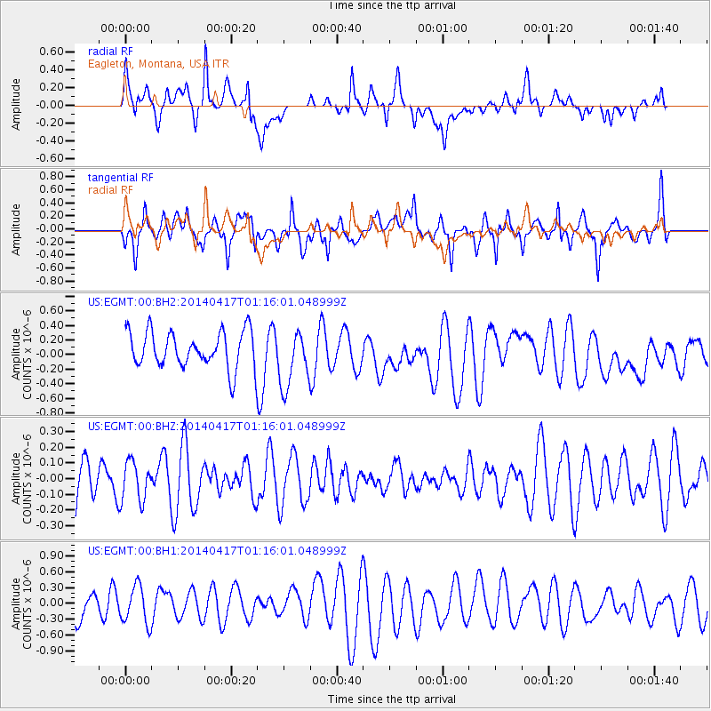
EGMT Eagleton, Montana, USA - Earthquake Result Viewer
*The percent match for this event was below the threshold and hence no stack was calculated.
| Earthquake location: |
W. Caroline Islands, Micronesia |
| Earthquake latitude/longitude: |
9.6/141.0 |
| Earthquake time(UTC): |
2014/04/17 (107) 01:03:07 GMT |
| Earthquake Depth: |
10 km |
| Earthquake Magnitude: |
5.3 MW |
| Earthquake Catalog/Contributor: |
ISC/ISC |
|
| Network: |
US United States National Seismic Network |
| Station: |
EGMT Eagleton, Montana, USA |
| Lat/Lon: |
48.02 N/109.75 W |
| Elevation: |
1055 m |
|
| Distance: |
95.5 deg |
| Az: |
39.538 deg |
| Baz: |
290.756 deg |
| Ray Param: |
$rayparam |
*The percent match for this event was below the threshold and hence was not used in the summary stack. |
|
| Radial Match: |
49.076546 % |
| Radial Bump: |
400 |
| Transverse Match: |
72.024734 % |
| Transverse Bump: |
400 |
| SOD ConfigId: |
3390531 |
| Insert Time: |
2019-04-11 10:36:44.888 +0000 |
| GWidth: |
2.5 |
| Max Bumps: |
400 |
| Tol: |
0.001 |
|
Signal To Noise
| Channel | StoN | STA | LTA |
| US:EGMT:00:BHZ:20140417T01:16:01.048999Z | 0.7946354 | 1.2331725E-7 | 1.5518721E-7 |
| US:EGMT:00:BH1:20140417T01:16:01.048999Z | 1.3192886 | 3.6702858E-7 | 2.7820187E-7 |
| US:EGMT:00:BH2:20140417T01:16:01.048999Z | 1.6078466 | 4.0032037E-7 | 2.489792E-7 |
| Arrivals |
| Ps | |
| PpPs | |
| PsPs/PpSs | |


