You are here: Home > Network List > UW - Pacific Northwest Regional Seismic Network Stations List
> Station UMAT Pilot Rock, OR, USA > Earthquake Result Viewer
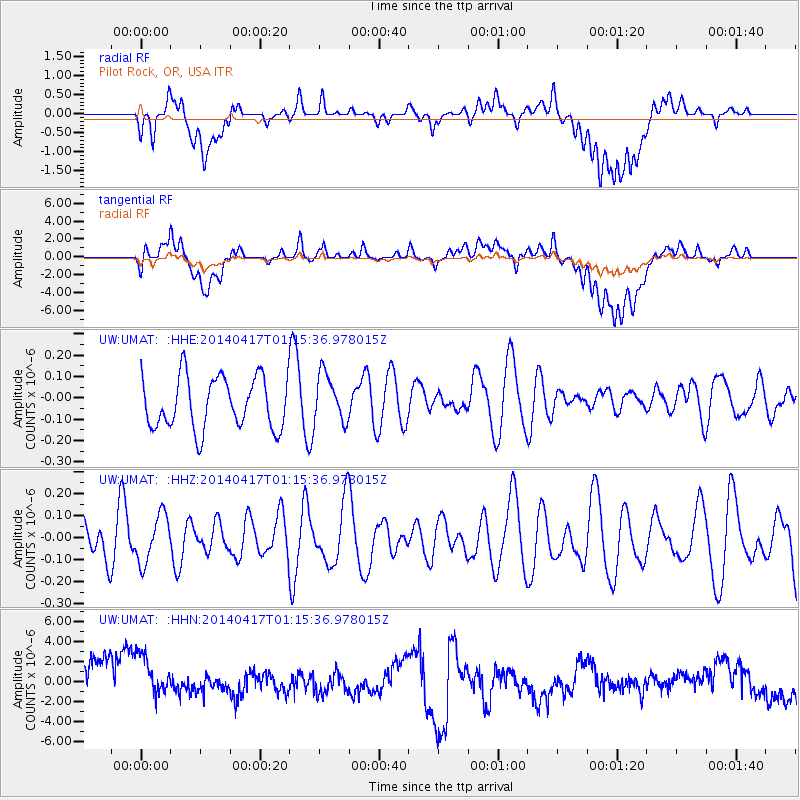
UMAT Pilot Rock, OR, USA - Earthquake Result Viewer
*The percent match for this event was below the threshold and hence no stack was calculated.
| Earthquake location: |
W. Caroline Islands, Micronesia |
| Earthquake latitude/longitude: |
9.6/141.0 |
| Earthquake time(UTC): |
2014/04/17 (107) 01:03:07 GMT |
| Earthquake Depth: |
10 km |
| Earthquake Magnitude: |
5.3 MW |
| Earthquake Catalog/Contributor: |
ISC/ISC |
|
| Network: |
UW Pacific Northwest Regional Seismic Network |
| Station: |
UMAT Pilot Rock, OR, USA |
| Lat/Lon: |
45.29 N/118.96 W |
| Elevation: |
1318 m |
|
| Distance: |
90.2 deg |
| Az: |
44.031 deg |
| Baz: |
283.851 deg |
| Ray Param: |
$rayparam |
*The percent match for this event was below the threshold and hence was not used in the summary stack. |
|
| Radial Match: |
31.9796 % |
| Radial Bump: |
400 |
| Transverse Match: |
27.77229 % |
| Transverse Bump: |
400 |
| SOD ConfigId: |
3390531 |
| Insert Time: |
2019-04-11 10:36:55.212 +0000 |
| GWidth: |
2.5 |
| Max Bumps: |
400 |
| Tol: |
0.001 |
|
Signal To Noise
| Channel | StoN | STA | LTA |
| UW:UMAT: :HHZ:20140417T01:15:36.978015Z | 1.0239447 | 1.0891129E-7 | 1.0636442E-7 |
| UW:UMAT: :HHN:20140417T01:15:36.978015Z | 1.3017699 | 2.6875396E-6 | 2.0645275E-6 |
| UW:UMAT: :HHE:20140417T01:15:36.978015Z | 0.94691163 | 1.1461638E-7 | 1.2104232E-7 |
| Arrivals |
| Ps | |
| PpPs | |
| PsPs/PpSs | |


