You are here: Home > Network List > TA - USArray Transportable Network (new EarthScope stations) Stations List
> Station U39A Green Forest, AR, USA > Earthquake Result Viewer
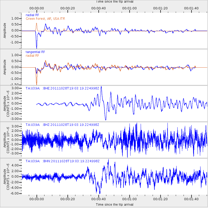
U39A Green Forest, AR, USA - Earthquake Result Viewer
*The percent match for this event was below the threshold and hence no stack was calculated.
| Earthquake location: |
Near Coast Of Peru |
| Earthquake latitude/longitude: |
-14.4/-76.0 |
| Earthquake time(UTC): |
2011/10/28 (301) 18:54:34 GMT |
| Earthquake Depth: |
24 km |
| Earthquake Magnitude: |
6.5 MB, 6.9 MS, 6.9 MW, 6.9 MW |
| Earthquake Catalog/Contributor: |
WHDF/NEIC |
|
| Network: |
TA USArray Transportable Network (new EarthScope stations) |
| Station: |
U39A Green Forest, AR, USA |
| Lat/Lon: |
36.38 N/93.48 W |
| Elevation: |
433 m |
|
| Distance: |
53.2 deg |
| Az: |
342.341 deg |
| Baz: |
158.642 deg |
| Ray Param: |
$rayparam |
*The percent match for this event was below the threshold and hence was not used in the summary stack. |
|
| Radial Match: |
67.97608 % |
| Radial Bump: |
307 |
| Transverse Match: |
48.24021 % |
| Transverse Bump: |
360 |
| SOD ConfigId: |
424168 |
| Insert Time: |
2012-02-16 11:03:32.244 +0000 |
| GWidth: |
2.5 |
| Max Bumps: |
400 |
| Tol: |
0.001 |
|
Signal To Noise
| Channel | StoN | STA | LTA |
| TA:U39A: :BHZ:20111028T19:03:19.224998Z | 0.9517961 | 8.6014813E-7 | 9.037105E-7 |
| TA:U39A: :BHN:20111028T19:03:19.224998Z | 0.9555949 | 5.4249193E-7 | 5.6770074E-7 |
| TA:U39A: :BHE:20111028T19:03:19.224998Z | 3.359451 | 5.7740993E-7 | 1.7187628E-7 |
| Arrivals |
| Ps | |
| PpPs | |
| PsPs/PpSs | |


