
HYB Hyderabad, India - Earthquake Result Viewer
| ||||||||||||||||||
| ||||||||||||||||||
| ||||||||||||||||||
|
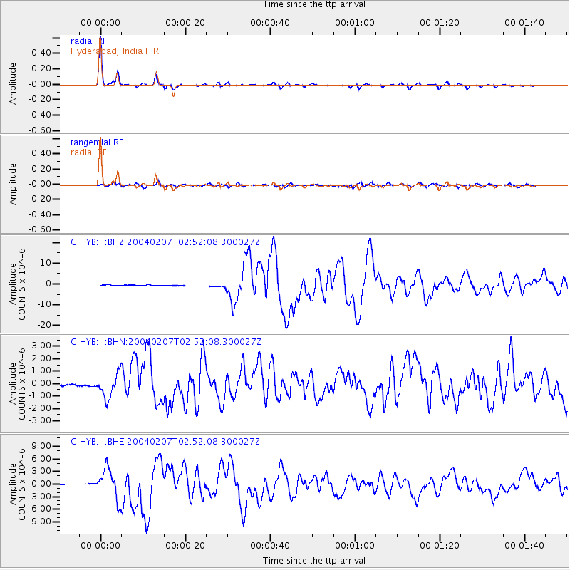
Signal To Noise
| Channel | StoN | STA | LTA |
| G:HYB: :BHN:20040207T02:52:08.300027Z | 12.416827 | 9.816174E-7 | 7.905542E-8 |
| G:HYB: :BHE:20040207T02:52:08.300027Z | 33.136333 | 3.7298526E-6 | 1.12560805E-7 |
| G:HYB: :BHZ:20040207T02:52:08.300027Z | 47.378468 | 9.001187E-6 | 1.8998477E-7 |
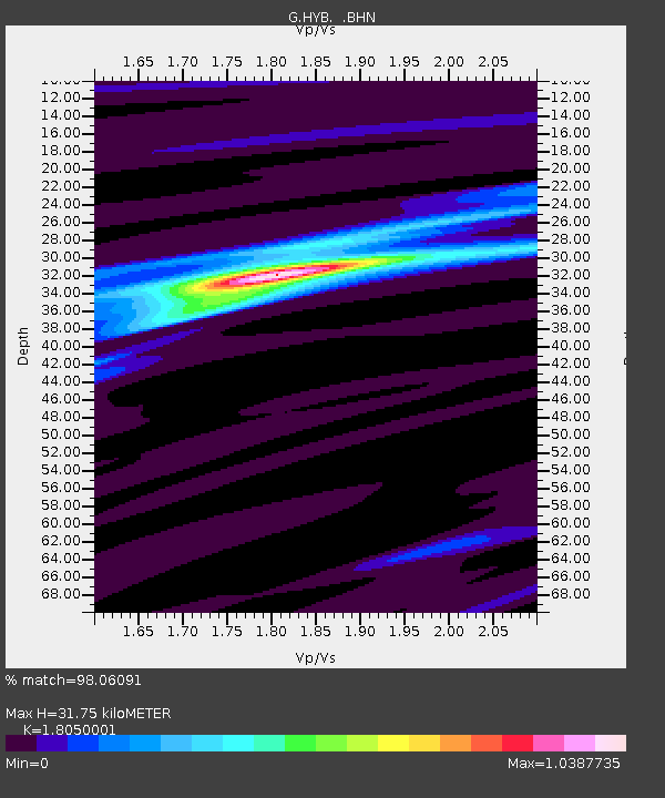
| Arrivals | |
| Ps | 4.1 SECOND |
| PpPs | 13 SECOND |
| PsPs/PpSs | 17 SECOND |

