You are here: Home > Network List > AZ - ANZA Regional Network Stations List
> Station LVA2 AZ.LVA2 > Earthquake Result Viewer
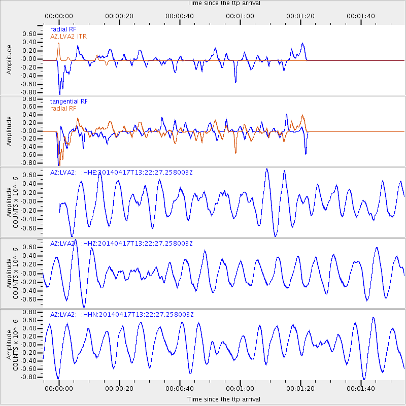
LVA2 AZ.LVA2 - Earthquake Result Viewer
*The percent match for this event was below the threshold and hence no stack was calculated.
| Earthquake location: |
Pacific-Antarctic Ridge |
| Earthquake latitude/longitude: |
-55.1/-129.5 |
| Earthquake time(UTC): |
2014/04/17 (107) 13:10:06 GMT |
| Earthquake Depth: |
16 km |
| Earthquake Magnitude: |
5.5 MB, 5.7 MWC |
| Earthquake Catalog/Contributor: |
NEIC PDE/NEIC COMCAT |
|
| Network: |
AZ ANZA Regional Network |
| Station: |
LVA2 AZ.LVA2 |
| Lat/Lon: |
33.35 N/116.56 W |
| Elevation: |
1435 m |
|
| Distance: |
88.8 deg |
| Az: |
10.802 deg |
| Baz: |
187.399 deg |
| Ray Param: |
$rayparam |
*The percent match for this event was below the threshold and hence was not used in the summary stack. |
|
| Radial Match: |
61.28238 % |
| Radial Bump: |
400 |
| Transverse Match: |
40.958263 % |
| Transverse Bump: |
400 |
| SOD ConfigId: |
3390531 |
| Insert Time: |
2019-04-11 10:41:35.293 +0000 |
| GWidth: |
2.5 |
| Max Bumps: |
400 |
| Tol: |
0.001 |
|
Signal To Noise
| Channel | StoN | STA | LTA |
| AZ:LVA2: :HHZ:20140417T13:22:27.258003Z | 2.4249775 | 3.8494235E-7 | 1.5874059E-7 |
| AZ:LVA2: :HHN:20140417T13:22:27.258003Z | 1.8722123 | 4.676113E-7 | 2.4976404E-7 |
| AZ:LVA2: :HHE:20140417T13:22:27.258003Z | 0.995948 | 3.5604938E-7 | 3.5749795E-7 |
| Arrivals |
| Ps | |
| PpPs | |
| PsPs/PpSs | |


