You are here: Home > Network List > TA - USArray Transportable Network (new EarthScope stations) Stations List
> Station U36A Oologah, OK, USA > Earthquake Result Viewer
U36A Oologah, OK, USA - Earthquake Result Viewer
*The percent match for this event was below the threshold and hence no stack was calculated.
| Earthquake location: |
Near Coast Of Peru |
| Earthquake latitude/longitude: |
-14.4/-76.0 |
| Earthquake time(UTC): |
2011/10/28 (301) 19:01:02 GMT |
| Earthquake Depth: |
22 km |
| Earthquake Magnitude: |
5.6 MB |
| Earthquake Catalog/Contributor: |
WHDF/NEIC |
|
| Network: |
TA USArray Transportable Network (new EarthScope stations) |
| Station: |
U36A Oologah, OK, USA |
| Lat/Lon: |
36.39 N/95.73 W |
| Elevation: |
187 m |
|
| Distance: |
53.8 deg |
| Az: |
340.275 deg |
| Baz: |
156.087 deg |
| Ray Param: |
$rayparam |
*The percent match for this event was below the threshold and hence was not used in the summary stack. |
|
| Radial Match: |
79.08255 % |
| Radial Bump: |
400 |
| Transverse Match: |
54.3723 % |
| Transverse Bump: |
400 |
| SOD ConfigId: |
424168 |
| Insert Time: |
2012-02-16 11:25:55.112 +0000 |
| GWidth: |
2.5 |
| Max Bumps: |
400 |
| Tol: |
0.001 |
|
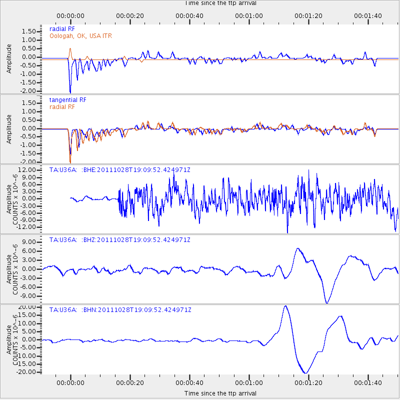
Signal To Noise
| Channel | StoN | STA | LTA |
| TA:U36A: :BHZ:20111028T19:09:52.424971Z | 0.50210804 | 5.62438E-7 | 1.1201533E-6 |
| TA:U36A: :BHN:20111028T19:09:52.424971Z | 0.9848766 | 6.219967E-7 | 6.315479E-7 |
| TA:U36A: :BHE:20111028T19:09:52.424971Z | 2.289928 | 5.038784E-6 | 2.2004115E-6 |
| Arrivals |
| Ps | |
| PpPs | |
| PsPs/PpSs | |


