You are here: Home > Network List > TA - USArray Transportable Network (new EarthScope stations) Stations List
> Station O03D Paynes Creek, CA, USA > Earthquake Result Viewer
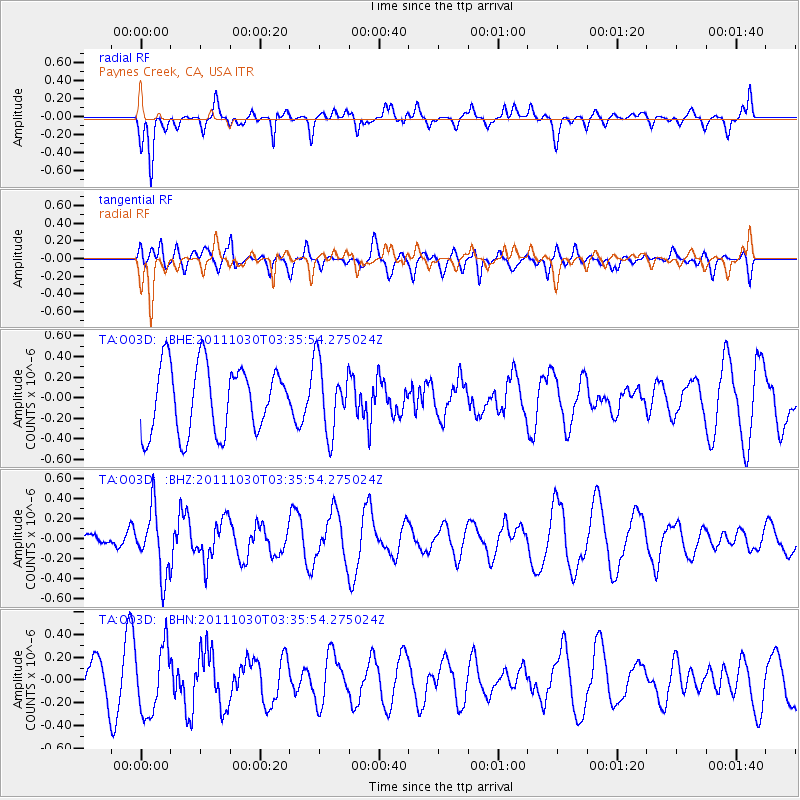
O03D Paynes Creek, CA, USA - Earthquake Result Viewer
*The percent match for this event was below the threshold and hence no stack was calculated.
| Earthquake location: |
Taiwan Region |
| Earthquake latitude/longitude: |
25.4/122.9 |
| Earthquake time(UTC): |
2011/10/30 (303) 03:23:46 GMT |
| Earthquake Depth: |
224 km |
| Earthquake Magnitude: |
5.7 MW, 5.4 MB, 5.7 MW |
| Earthquake Catalog/Contributor: |
WHDF/NEIC |
|
| Network: |
TA USArray Transportable Network (new EarthScope stations) |
| Station: |
O03D Paynes Creek, CA, USA |
| Lat/Lon: |
40.29 N/121.80 W |
| Elevation: |
968 m |
|
| Distance: |
91.2 deg |
| Az: |
43.747 deg |
| Baz: |
305.129 deg |
| Ray Param: |
$rayparam |
*The percent match for this event was below the threshold and hence was not used in the summary stack. |
|
| Radial Match: |
58.091904 % |
| Radial Bump: |
400 |
| Transverse Match: |
46.789726 % |
| Transverse Bump: |
400 |
| SOD ConfigId: |
424168 |
| Insert Time: |
2012-02-17 12:46:38.963 +0000 |
| GWidth: |
2.5 |
| Max Bumps: |
400 |
| Tol: |
0.001 |
|
Signal To Noise
| Channel | StoN | STA | LTA |
| TA:O03D: :BHZ:20111030T03:35:54.275024Z | 2.6131923 | 3.2446027E-7 | 1.2416243E-7 |
| TA:O03D: :BHN:20111030T03:35:54.275024Z | 2.4399848 | 2.8915153E-7 | 1.1850547E-7 |
| TA:O03D: :BHE:20111030T03:35:54.275024Z | 1.0496916 | 3.4266745E-7 | 3.2644584E-7 |
| Arrivals |
| Ps | |
| PpPs | |
| PsPs/PpSs | |


