HYB Hyderabad, India - Earthquake Result Viewer
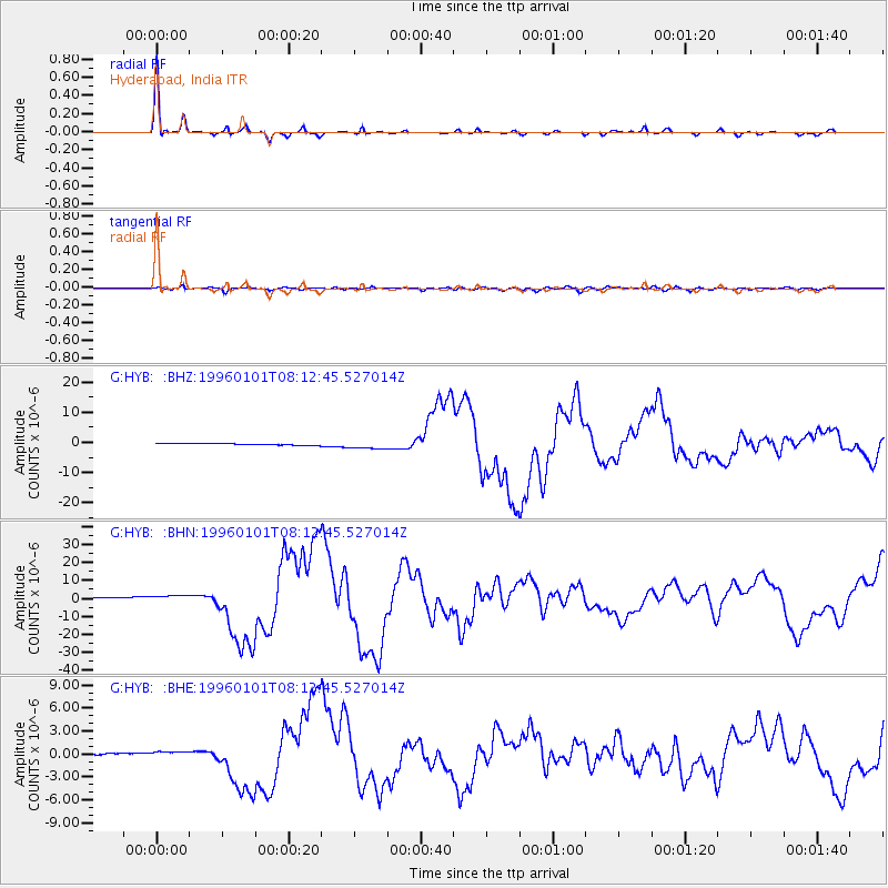
Earthquake location: Minahassa Peninsula, Sulawesi
Earthquake latitude/longitude: 0.7/120.0
Earthquake time(UTC): 1996/01/01 (001) 08:05:11 GMT
Earthquake Depth: 33 km
Earthquake Magnitude: 6.2 MB, 7.7 MS, 7.8 UNKNOWN, 7.8 MW
Earthquake Catalog/Contributor: WHDF/NEIC
Network: G GEOSCOPE
Station: HYB Hyderabad, India
Lat/Lon: 17.42 N/78.55 E
Elevation: 510 m
Distance: 44.0 deg
Az: 294.545 deg
Baz: 107.693 deg
Ray Param: 0.07213094
Estimated Moho Depth: 33.0 km
Estimated Crust Vp/Vs: 1.75
Assumed Crust Vp: 6.459 km/s
Estimated Crust Vs: 3.691 km/s
Estimated Crust Poisson's Ratio: 0.26
Radial Match: 96.71342 %
Radial Bump: 245
Transverse Match: 75.81245 %
Transverse Bump: 400
SOD ConfigId: 4480
Insert Time: 2010-02-26 22:44:42.546 +0000
GWidth: 2.5
Max Bumps: 400
Tol: 0.001

Signal To Noise

ChannelStoNSTALTA
G:HYB: :BHN:19960101T08:12:45.527014Z3.6146311.7842897E-64.9362984E-7
G:HYB: :BHE:19960101T08:12:45.527014Z4.0587583.774231E-79.29898E-8
G:HYB: :BHZ:19960101T08:12:45.527014Z4.72820571.3142145E-62.7795207E-7
Arrivals
Ps4.1 SECOND
PpPs13 SECOND
PsPs/PpSs17 SECOND