You are here: Home > Network List > IC - New China Digital Seismograph Network Stations List
> Station ENH Enshi, Hubei Province, China > Earthquake Result Viewer
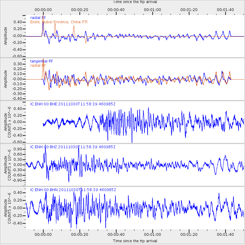
ENH Enshi, Hubei Province, China - Earthquake Result Viewer
*The percent match for this event was below the threshold and hence no stack was calculated.
| Earthquake location: |
Southern Sumatra, Indonesia |
| Earthquake latitude/longitude: |
-3.2/101.3 |
| Earthquake time(UTC): |
2011/10/30 (303) 11:52:27 GMT |
| Earthquake Depth: |
36 km |
| Earthquake Magnitude: |
5.6 MB, 5.1 MS, 5.6 MW, 5.6 MW |
| Earthquake Catalog/Contributor: |
WHDF/NEIC |
|
| Network: |
IC New China Digital Seismograph Network |
| Station: |
ENH Enshi, Hubei Province, China |
| Lat/Lon: |
30.28 N/109.49 E |
| Elevation: |
500 m |
|
| Distance: |
34.2 deg |
| Az: |
12.59 deg |
| Baz: |
194.57 deg |
| Ray Param: |
$rayparam |
*The percent match for this event was below the threshold and hence was not used in the summary stack. |
|
| Radial Match: |
66.84971 % |
| Radial Bump: |
400 |
| Transverse Match: |
61.471794 % |
| Transverse Bump: |
400 |
| SOD ConfigId: |
424168 |
| Insert Time: |
2012-02-17 12:52:02.911 +0000 |
| GWidth: |
2.5 |
| Max Bumps: |
400 |
| Tol: |
0.001 |
|
Signal To Noise
| Channel | StoN | STA | LTA |
| IC:ENH:00:BHZ:20111030T11:58:39.460985Z | 4.5665684 | 4.0322823E-7 | 8.8300055E-8 |
| IC:ENH:00:BHN:20111030T11:58:39.460985Z | 1.4960831 | 1.9124448E-7 | 1.2783012E-7 |
| IC:ENH:00:BHE:20111030T11:58:39.460985Z | 1.7770208 | 1.3511848E-7 | 7.603652E-8 |
| Arrivals |
| Ps | |
| PpPs | |
| PsPs/PpSs | |


