You are here: Home > Network List > IU - Global Seismograph Network (GSN - IRIS/USGS) Stations List
> Station GRFO Grafenberg, Germany > Earthquake Result Viewer
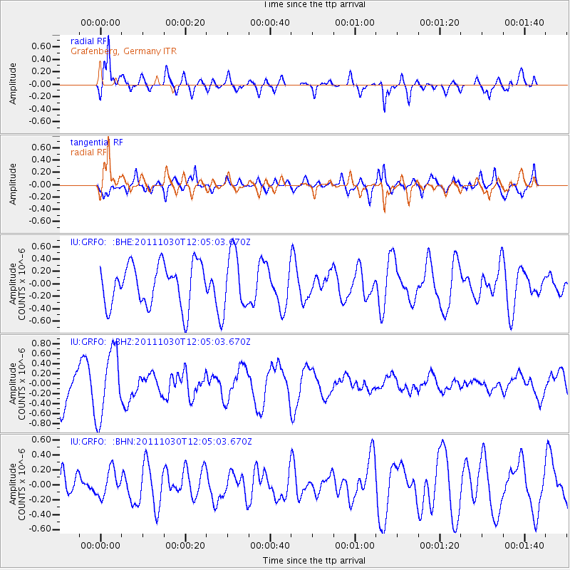
GRFO Grafenberg, Germany - Earthquake Result Viewer
*The percent match for this event was below the threshold and hence no stack was calculated.
| Earthquake location: |
Southern Sumatra, Indonesia |
| Earthquake latitude/longitude: |
-3.2/101.3 |
| Earthquake time(UTC): |
2011/10/30 (303) 11:52:27 GMT |
| Earthquake Depth: |
36 km |
| Earthquake Magnitude: |
5.6 MB, 5.1 MS, 5.6 MW, 5.6 MW |
| Earthquake Catalog/Contributor: |
WHDF/NEIC |
|
| Network: |
IU Global Seismograph Network (GSN - IRIS/USGS) |
| Station: |
GRFO Grafenberg, Germany |
| Lat/Lon: |
49.69 N/11.22 E |
| Elevation: |
384 m |
|
| Distance: |
92.5 deg |
| Az: |
319.453 deg |
| Baz: |
92.003 deg |
| Ray Param: |
$rayparam |
*The percent match for this event was below the threshold and hence was not used in the summary stack. |
|
| Radial Match: |
77.25446 % |
| Radial Bump: |
400 |
| Transverse Match: |
64.10444 % |
| Transverse Bump: |
400 |
| SOD ConfigId: |
424168 |
| Insert Time: |
2012-02-17 12:52:30.231 +0000 |
| GWidth: |
2.5 |
| Max Bumps: |
400 |
| Tol: |
0.001 |
|
Signal To Noise
| Channel | StoN | STA | LTA |
| IU:GRFO: :BHZ:20111030T12:05:03.670Z | 1.9647095 | 6.607632E-7 | 3.3631596E-7 |
| IU:GRFO: :BHN:20111030T12:05:03.670Z | 0.8133958 | 1.7915262E-7 | 2.202527E-7 |
| IU:GRFO: :BHE:20111030T12:05:03.670Z | 1.3408914 | 4.4951648E-7 | 3.3523705E-7 |
| Arrivals |
| Ps | |
| PpPs | |
| PsPs/PpSs | |


