You are here: Home > Network List > TA - USArray Transportable Network (new EarthScope stations) Stations List
> Station T41A Mountain View, MO, USA > Earthquake Result Viewer
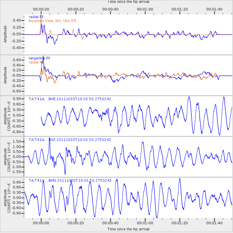
T41A Mountain View, MO, USA - Earthquake Result Viewer
*The percent match for this event was below the threshold and hence no stack was calculated.
| Earthquake location: |
Near Coast Of Northern Chile |
| Earthquake latitude/longitude: |
-25.7/-71.0 |
| Earthquake time(UTC): |
2011/10/30 (303) 18:53:43 GMT |
| Earthquake Depth: |
47 km |
| Earthquake Magnitude: |
5.7 MB, 5.4 MS, 5.7 MW, 5.8 MW |
| Earthquake Catalog/Contributor: |
WHDF/NEIC |
|
| Network: |
TA USArray Transportable Network (new EarthScope stations) |
| Station: |
T41A Mountain View, MO, USA |
| Lat/Lon: |
37.04 N/91.76 W |
| Elevation: |
366 m |
|
| Distance: |
65.5 deg |
| Az: |
341.794 deg |
| Baz: |
159.38 deg |
| Ray Param: |
$rayparam |
*The percent match for this event was below the threshold and hence was not used in the summary stack. |
|
| Radial Match: |
43.280865 % |
| Radial Bump: |
400 |
| Transverse Match: |
79.08133 % |
| Transverse Bump: |
400 |
| SOD ConfigId: |
424168 |
| Insert Time: |
2012-02-17 13:06:51.739 +0000 |
| GWidth: |
2.5 |
| Max Bumps: |
400 |
| Tol: |
0.001 |
|
Signal To Noise
| Channel | StoN | STA | LTA |
| TA:T41A: :BHZ:20111030T19:03:50.275024Z | 1.8883343 | 6.806602E-7 | 3.6045535E-7 |
| TA:T41A: :BHN:20111030T19:03:50.275024Z | 1.7402323 | 6.621444E-7 | 3.8049194E-7 |
| TA:T41A: :BHE:20111030T19:03:50.275024Z | 0.9726856 | 2.6366536E-7 | 2.7106947E-7 |
| Arrivals |
| Ps | |
| PpPs | |
| PsPs/PpSs | |


