You are here: Home > Network List > TA - USArray Transportable Network (new EarthScope stations) Stations List
> Station X45A UM Field Station, Abbeville, MS, USA > Earthquake Result Viewer
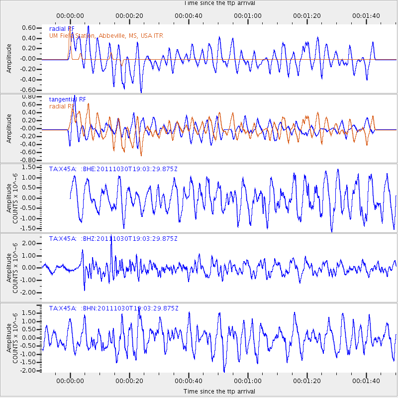
X45A UM Field Station, Abbeville, MS, USA - Earthquake Result Viewer
*The percent match for this event was below the threshold and hence no stack was calculated.
| Earthquake location: |
Near Coast Of Northern Chile |
| Earthquake latitude/longitude: |
-25.7/-71.0 |
| Earthquake time(UTC): |
2011/10/30 (303) 18:53:43 GMT |
| Earthquake Depth: |
47 km |
| Earthquake Magnitude: |
5.7 MB, 5.4 MS, 5.7 MW, 5.8 MW |
| Earthquake Catalog/Contributor: |
WHDF/NEIC |
|
| Network: |
TA USArray Transportable Network (new EarthScope stations) |
| Station: |
X45A UM Field Station, Abbeville, MS, USA |
| Lat/Lon: |
34.42 N/89.39 W |
| Elevation: |
142 m |
|
| Distance: |
62.3 deg |
| Az: |
342.835 deg |
| Baz: |
161.217 deg |
| Ray Param: |
$rayparam |
*The percent match for this event was below the threshold and hence was not used in the summary stack. |
|
| Radial Match: |
52.07956 % |
| Radial Bump: |
400 |
| Transverse Match: |
64.81512 % |
| Transverse Bump: |
400 |
| SOD ConfigId: |
424168 |
| Insert Time: |
2012-02-17 13:06:58.824 +0000 |
| GWidth: |
2.5 |
| Max Bumps: |
400 |
| Tol: |
0.001 |
|
Signal To Noise
| Channel | StoN | STA | LTA |
| TA:X45A: :BHZ:20111030T19:03:29.875Z | 3.7077682 | 5.7128074E-7 | 1.5407672E-7 |
| TA:X45A: :BHN:20111030T19:03:29.875Z | 1.3375204 | 7.0189344E-7 | 5.2477213E-7 |
| TA:X45A: :BHE:20111030T19:03:29.875Z | 0.6927105 | 4.1430636E-7 | 5.9809446E-7 |
| Arrivals |
| Ps | |
| PpPs | |
| PsPs/PpSs | |


