You are here: Home > Network List > CI - Caltech Regional Seismic Network Stations List
> Station DAN Danby, California, USA > Earthquake Result Viewer
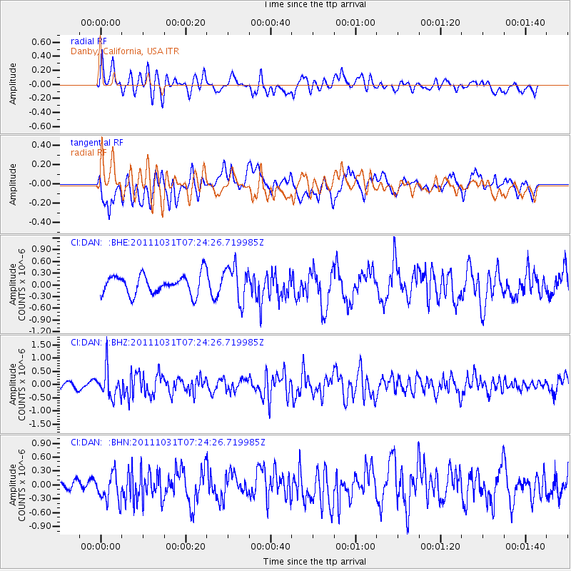
DAN Danby, California, USA - Earthquake Result Viewer
*The percent match for this event was below the threshold and hence no stack was calculated.
| Earthquake location: |
Rat Islands, Aleutian Islands |
| Earthquake latitude/longitude: |
52.4/177.9 |
| Earthquake time(UTC): |
2011/10/31 (304) 07:16:21 GMT |
| Earthquake Depth: |
159 km |
| Earthquake Magnitude: |
5.8 MB, 5.8 MW, 5.9 MW |
| Earthquake Catalog/Contributor: |
WHDF/NEIC |
|
| Network: |
CI Caltech Regional Seismic Network |
| Station: |
DAN Danby, California, USA |
| Lat/Lon: |
34.64 N/115.38 W |
| Elevation: |
398 m |
|
| Distance: |
49.7 deg |
| Az: |
83.284 deg |
| Baz: |
312.391 deg |
| Ray Param: |
$rayparam |
*The percent match for this event was below the threshold and hence was not used in the summary stack. |
|
| Radial Match: |
56.869465 % |
| Radial Bump: |
400 |
| Transverse Match: |
53.690132 % |
| Transverse Bump: |
400 |
| SOD ConfigId: |
424168 |
| Insert Time: |
2012-02-17 13:19:54.767 +0000 |
| GWidth: |
2.5 |
| Max Bumps: |
400 |
| Tol: |
0.001 |
|
Signal To Noise
| Channel | StoN | STA | LTA |
| CI:DAN: :BHZ:20111031T07:24:26.719985Z | 3.3357263 | 5.55148E-7 | 1.6642493E-7 |
| CI:DAN: :BHN:20111031T07:24:26.719985Z | 1.8466842 | 3.1120263E-7 | 1.6851968E-7 |
| CI:DAN: :BHE:20111031T07:24:26.719985Z | 1.8619041 | 4.650374E-7 | 2.497644E-7 |
| Arrivals |
| Ps | |
| PpPs | |
| PsPs/PpSs | |


